Destination Guides

Find out more about various destinations and dive deeper with the ultimate guides that cover all the doubts anyone could have.

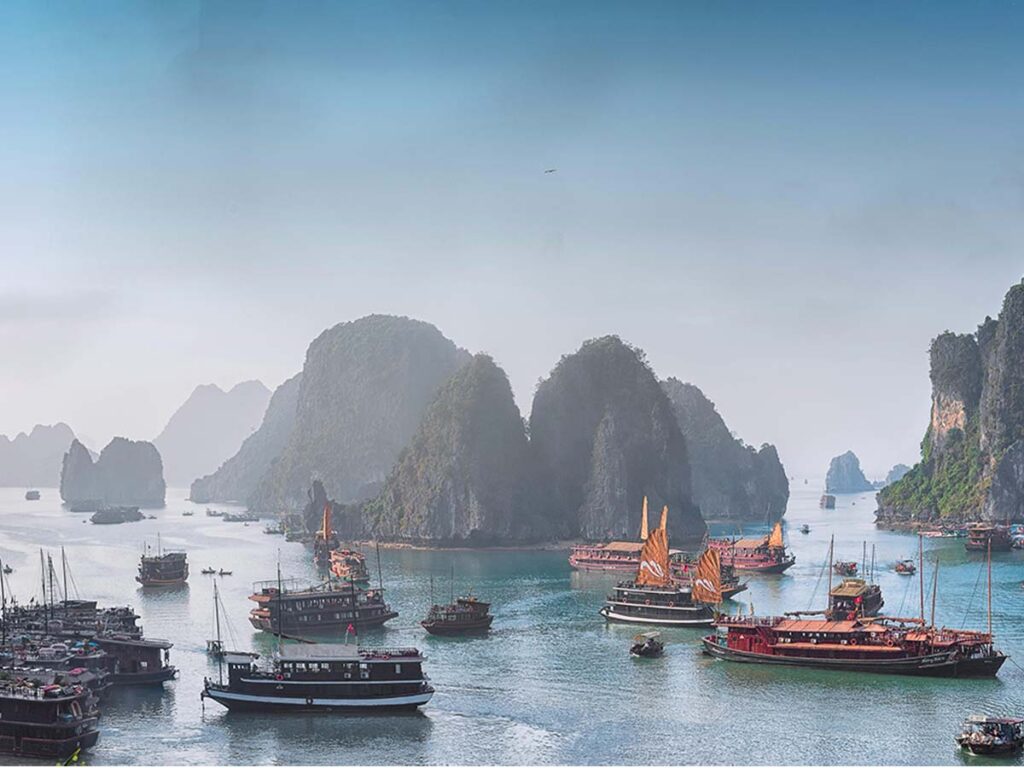
A high-angle, scenic view of Ha Long Bay in Vietnam. Its is one of the best things to do in Vietnam. Numerous traditional wooden junk boats and cruise ships float across the calm, greenish-blue water. In the background, massive, steep limestone karsts covered in green vegetation rise out of the sea, fading into a hazy, light blue horizon.

Things to Do in Vietnam: An Ultimate Guide About Experiences That Actually Matter

There’s a specific kind of traveller who books two weeks in Vietnam and ends up rescheduling their flight home. You’ll meet them in every guesthouse from Hanoi to Phu Quoc and can easily be differentiated slightly sunburned, holding a bowl of pho they didn’t ask for but can’t stop eating, already making plans to come back. Vietnam does that. It earns that loyalty through sheer sensory overload: the food, the noise, the landscapes, the history, and the warmth of people who seem genuinely unbothered by how many backpackers have tramped through their streets. If you’re putting together your Vietnam itinerary and wondering what to prioritize, this guide cuts through the noise. Whether you’re planning your first Southeast Asia trip or your fourth return to Vietnam, these are the experiences that actually hold up. Before diving in, if you want a structured starting point for your trip, The Travel Story’s Vietnam travel packages are worth a look. It is curated for backpackers and travel enthusiasts, covering most of the part without being rushed. Quick Answer Vietnam offers 50+ diverse activities across three distinct regions. Northern Vietnam features cultural cities like Hanoi and natural wonders like Halong Bay. Central Vietnam showcases heritage sites in Hoi An and adventure activities in Da Nang. Southern Vietnam includes the bustling Ho Chi Minh City and tropical Phu Quoc Island. The best time to visit is October through April when weather is stable across all regions. Hanoi: Where Vietnam’s Soul Lives on the Street Land in Hanoi and take a walk into Hanoi’s Old Quarter and you’re walking into organised chaos. Thirty-six streets, each historically named after the trade practiced there — silk street, paper street, tin street. The Old Quarter isn’t a museum. It’s a living, breathing neighbourhood where people actually live and work. You’ll see grandmothers selling flowers from the same spot their mothers sold flowers. Teenagers on motorbikes weaving through crowds. Vendors setting up for the evening rush. Here’s what to actually do: Wander and explore cafes, eat pho at a place with plastic stools and no English menu. Sit at a street-side or go directly to Train Street where trains runs through right next to cafés and watch the city move around you. Visit Hoan Kiem Lake at sunrise when locals are exercising and the city is still quiet. Don’t skip the Temple of Literature — Vietnam’s first national university, founded in 1070. It’s genuinely beautiful and chronically underrated compared to the touristy frenzy around the Ho Chi Minh Mausoleum complex nearby. Best time: Early morning (6-8 AM) or evening (5-7 PM) Halong Bay: More Than Just a Scenic Cruise Halong Bay is famous. Too famous, maybe. Which means most travelers show up, take photos of the limestone karsts, and leave thinking they’ve seen Vietnam. But it doesn’t change the fact that the cruise ride worth every hype. The scenery is stunning. Thousands of limestone islands rising from the water like something from a fantasy film. But Halong Bay is actually a UNESCO World Heritage Site because of its geological significance, not just its beauty. The karsts tell a story about how the earth moves and changes over millions of years. Real things to do in Halong Bay go beyond the standard cruise. Kayak through hidden lagoons where you’ll see caves that few tourists ever reach. You can also visit Cat Ba Island and hike to the viewpoint where you can see the entire bay spread out below you. Snorkel in areas where the water is actually clear and you can see fish. Best time: October-November, March-April Sapa: Misty Mountains and Rooftop Of Vietnam Sapa sits in the mountains of northern Vietnam, about 350 kilometers from Hanoi. It’s high enough that it gets cold. High enough that it gets misty. High enough that you feel genuinely far from the chaos of the cities. The main thing to do in Sapa is trek through rice terraces that have been farmed the same way for centuries and walk past villages where people still dress in traditional clothing, not because it’s for tourists, but because it’s how they dress. You’ll meet Hmong families who will invite you into their homes and offer you tea. Visit the “Rooftop of Vietnam” Fansipan Peak which is the highest peak of Indochinese Peninsula. You can take a 15-minute panoramic cable car ride to reach on top of the Fansipan Peak. Best time: September-November, March-May Ninh Binh: The Underrated Alternative Ninh Binh is what Halong Bay was before it became famous. Sometimes called “Ha Long Bay on Land” and it is growing in popularity, and for good reason. Limestone karsts, caves, rivers, and villages—all the same geological drama, but without the crowds. Things to do in Ninh Binh include boat rides through Trang An, where you’ll float through caves and past villages. Climbing Mua Cave’s 500 steps rewards you with views that rival anything in northern Vietnam. Visiting Hoa Lu, the ancient capital, teaches you about Vietnamese history in a way textbooks never can. The real advantage of Ninh Binh? You can actually breathe. You can sit by the river without feeling like you’re in a theme park. You can have conversations with locals who aren’t used to seeing fifty tour groups a day. Best time: October-April Hoi An: The Town That Refused to Change Hoi An is a 15th-century trading port that somehow survived wars, colonization, and modernization. The entire town is a UNESCO World Heritage Site because the architecture, the layout, the energy—it all feels like stepping into another century. Hoi An is also the most photogenic town in Vietnam, and it knows it. The lantern-lit Old Town at night is the postcard everyone sends home. But beyond the aesthetic, there’s real substance here. Best time: October-April Da Nang: Beach & Beyond Da Nang is Vietnam’s main beach destination, but it’s also a gateway to mountains, caves, and adventure. The city itself is modern and comfortable, but the real Vietnam activities happen outside the city. Ba Na

Things to Do in Vietnam: An Ultimate Guide About Experiences That Actually Matter Read More »

Chandratal Lake with turquoise colour water surrounded by Rocky mountains

Chandratal Lake: The Complete Travel Guide For 2026 

There are some moments that remain with you forever and just like that somewhere between Kunzum Pass and the edge of the Spiti Valley where the road ends, the silence swallows everything a crescent-shaped lake appears out of nowhere, shimmering in shades of blue and green that don’t feel like they belong on this planet. That’s Chandratal. And once you see it, it’s very hard to stop thinking about it. If you’ve been researching Himalayan lakes and wondering whether Chandratal is worth the effort then without a second thought you should go for it but if you have no idea how to reach there on your own then you just need to join our Spiti with Chandratal batches . But only if you go in prepared. This guide will tell you exactly what Chandratal is, why it matters, when to go, how to get there, and what nobody tells you before you leave. Why Chandratal Lake Is Special? Chandratal Lake sits at an altitude of roughly 4,300 metres (14,100 feet) in the Lahaul and Spiti district of Himachal Pradesh. The name means “Moon Lake” in Hindi — named for its distinctive crescent shape when viewed from above. It’s part of the Chandratal Wildlife Sanctuary and is listed as a Ramsar Wetland of International Importance, which means it’s ecologically protected. The lake feeds into the Chandra River, a tributary of the Chenab. Beyond geography, Chandratal carries real cultural weight. Local legend holds that this is where the god Indra descended to take the legendary warrior Yudhishthira to heaven, leaving his human body behind at the water’s edge. Whether or not you follow the mythology, standing at that shore — sky above, snow peaks all around, zero phone signal — it’s not hard to see why people believed something divine happened here. What makes this lake so different from more popular Himalayan lakes like Pangong Tso is the relative rawness of the experience. There’s no town nearby. No chai shops right at the edge. No loud tourists roaming around. You park your vehicle, walk 1-1.5 km, and then you reach Chandrataal where you are completely alone with the lake. That’s increasingly rare in the Indian Himalayas. Best Time to Visit Chandratal Lake This is one of the most important decisions you’ll make. Chandratal isn’t accessible year-round. The road to the lake is buried under snow from October to May, and getting the timing wrong means either a wasted trip or a dangerous one. June to mid-July is the most popular window. The snow is melting, the landscape is green and dramatic, and the sky is usually clear. Temperatures at the lake range from 5°C to 10°C during the day and drop to near freezing at night. Mid-July to August brings the monsoon. The Manali route can become risky due to landslides and flooded roads. If you’re approaching via Shimla and Spiti, the risk is lower (Spiti sits in a rain shadow), but it’s still worth monitoring the road conditions daily. September to early October is arguably the best time for experienced trekkers and photographers. The crowds thin out significantly, the air is crystal clear, and the high-altitude colours shift to warm, earthy tones. However, temperatures drop fast — night temperatures can fall below -10°C by late September. After mid-October — don’t bother. The roads close, and anything beyond that is for trained mountaineers only. Period Conditions Best For June – mid-July Open, green, mild First-timers Mid-July – August Monsoon risk (Manali side) Spiti-side travellers September – early Oct Clear, cold, fewer crowds Photographers, trekkers After mid-October Roads closed Avoid How to Reach Chandratal: Your Route Options There are two main routes to Chandratal, and they’re not equally easy. Your starting point, travel budget, and risk tolerance should determine which one you pick. Route 1: From Manali via Atal Tunnel Distance: ~115 km from Manali to ChandratalEstimated travel time: 6–8 hours (on a good day)Road condition: Very rough. This is the shorter route, and the one most adventure travellers use. Here’s the sequence: How to travel: Private taxis from Manali (Innova or Bolero) and Organized tours that include Chandratal cost ₹8,000–₹15,000 per person for 2-3 day itineraries. Route 2: From Shimla via Spiti Valley (Kinnaur-Spiti Route) Distance: ~430 km from Shimla to ChandratalEstimated travel time: 3–4 daysRoad condition: Long, but generally better maintained than the Manali route This is the classic Spiti Valley road trip route. You drive through Kinnaur, then Spiti, and approach Chandratal from the Losar side. How to travel: Most people doing this route book either private tours or group tours. Buses from Shimla to Kaza run a few days a week (HRTC), and from Kaza you can arrange local transport to Chandratal. Scenic highlights: Kinnaur Valley and its apple orchards, Nako Lake, Pin Valley, Key Monastery near Kaza, Chicham Bridge (the highest motor bridge in Asia), the vast open expanse of Spiti. This route is highly recommended if you have 7-9 days and want a complete Himalayan road trip, not just a quick lake visit. Practical Tips and Safety Advice This is where most travel blogs either skip to pretty photos or give vague advice. Here’s the honest version: Altitude sickness is real. At 4,300m, even fit people feel the altitude. If you’re coming from Delhi, don’t rush straight to Chandratal in one day. Spend at least one night in Manali (2,050m) or ascend gradually from Shimla. Headaches, nausea, and dizziness are warning signs. Shortness of breath at rest or confusion means you need to descend immediately. Weather can turn fast. Even in June, snowstorms can appear without warning at this altitude. Check weather forecasts, carry warm layers regardless of the daytime temperature, and have a plan if you need to turn back. The road is genuinely bad. Do not attempt the Kunzum Pass road in a vehicle that isn’t built for high-clearance, rough terrain. Breakdowns in this area are serious because mobile networks are non-existent near the lake and the nearest mechanic is hours away. Carry enough

Chandratal Lake: The Complete Travel Guide For 2026  Read More »

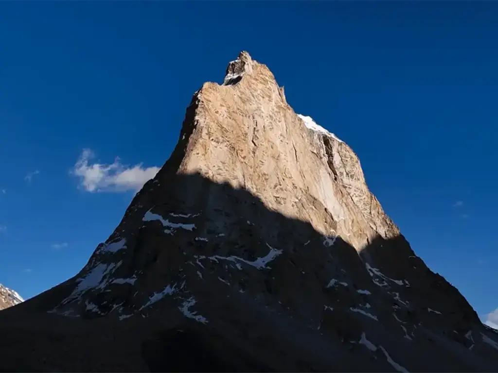
Night Sky at Gonbo Rangjon Zanskar Valley

Zanskar Valley: The Unknown Side of Himalayas

If we talk about the Himalayas, many envision the popular landscapes of Ladakh or Himachal. Yet, situated deeper within this grand picturesque of mountains lies a realm less known and lesser traversed, a place of profound beauty and rugged charm that calls out all the true adventurers: Zanskar Valley. Often described as one of India’s last untouched frontiers, Zanskar offers an experience that goes beyond typical tourism, inviting travellers into a world where ancient traditions thrive amidst breathtaking natural grandeur. This comprehensive guide will take you on a virtual journey through Zanskar Valley, revealing its unique geography, rich cultural heritage, and the practicalities of planning an expedition to this remote jewel. From navigating its challenging roads to exploring its cliff-hanging monasteries, prepare to uncover why a visit to Zanskar Valley isn’t just a trip, but a transformative encounter with the soul of the Himalayas. What and Where is Zanskar Valley? Zanskar Valley is a high-altitude semi-desert region situated in the Kargil district of Ladakh, in the northernmost part of India. Geographically, it’s a sub-district of Ladakh, yet culturally and scenically, it stands distinct. To locate it on a map, one would typically find Leh and then journey south, crossing the formidable Zanskar Range, a majestic sub-range of the Himalayas. The valley itself is carved dramatically by the Zanskar River, which flows through deep gorges before eventually merging with the mighty Indus River near Nimmu. This elongated valley stretches for approximately 300 kilometers, with its average altitude ranging from a challenging 3,500 to 4,400 meters above sea level. The administrative and cultural heart of Zanskar is Padum, a tranquil settlement that, despite its significance, retains the charm of a remote village. Here, a handful of homestays and a modest market serve as the primary hubs, all under the watchful gaze of towering, snow-capped peaks. Why You Should Visit Zanskar Valley What truly sets Zanskar Valley apart from other Himalayan destinations isn’t merely its elevation or its challenging accessibility; it’s profound sense of identity. Zanskar is a living museum of Tibetan Buddhist culture, where ancient traditions are not just preserved but actively practiced. The local dialect, the distinctive customs, and the numerous monasteries, many of which are architectural marvels built directly into cliff faces, all contribute to an atmosphere unlike anywhere else. Perhaps the most iconic example is Phugtal Gompa, a monastery literally embedded within a natural cave in a canyon wall. Its origins trace back over 2,500 years, and it remains accessible primarily by foot, a testament to Zanskar’s enduring isolation and spiritual depth. Visiting Zanskar is not merely observing a culture; it’s stepping into a vibrant, ancient world that continues to unfold in harmony with its rugged environment. It’s a place that demands effort to reach, but rewards with an authenticity that stays with you long after you’ve left. How to Reach Zanskar Valley Reaching Zanskar Valley is an adventure in itself, requiring careful planning and a spirit of resilience. There are no direct flights or railway lines; the journey is intrinsically linked to the mountain roads, which are often dictated by the whims of weather. However, recent developments are making Zanskar more accessible. Traditional Routes To Zanskar Valley: 1.Via Leh and drive to Padum (The Classic Approach): •Fly to Leh: The most common starting point is to fly into Leh, the capital of Ladakh. Daily flights connect Leh with major Indian cities. •Leh to Padum: From Leh, a scenic and lonely drive of approximately 9 hours (around 370 km) takes you to Padum, we suggest you take a day for rest and acclimatization in Leh before you leave for Padum. 2.Via Srinagar and Kargil: •This route offers an alternative for those who prefer to bypass Leh initially. Fly or drive to Srinagar, then proceed to Kargil, and finally to Padum. The Srinagar-Kargil stretch is roughly 200 km on NH1. 3.Via Manali (The Adventurous Road Trip): •For the ultimate road trip enthusiast, driving from Delhi via Manali, this route offers you scenic and dramatic landscape changes on the way. However, it is necessary to take a halt in Manali for a day before you start your journey to Purne as the elevation almost doubles after reaching Purne. The Game-Changer: Shinku La Pass A significant development for connectivity to Zanskar Valley is the Shinku La Pass (5,091m). This high-altitude pass now provides a direct link between Darcha in Himachal Pradesh (near Manali) and Padum in Zanskar. This route significantly shortens travel time for those coming from the Manali side, making Zanskar more accessible. The Darcha-Padum road via Shinku La typically opens earlier than Pensi La, often by mid-May, and remains open until mid-October, depending on snow conditions. Important Note: Road conditions in the Himalayas are unpredictable. Always check the latest road status before planning your journey, especially for Pensi La and Shinku La. Permits may also be required for certain areas. Best Time to Visit Zanskar Valley The ideal time to visit Zanskar Valley largely depends on the kind of experience you seek. Each season offers a distinct charm and set of challenges. 1. Summer (June to September): The Peak Season This is undoubtedly the best time to visit Zanskar Valley for most travelers. The weather is relatively stable, and crucially, all major roads and passes, including Pensi La and Shinku La, are open. Temperatures during the day are pleasant, ranging from 15°C to 25°C, though nights can still be chilly (5°C to 10°C). This period is perfect for: •Sightseeing: Explore monasteries, villages, and enjoy the vibrant green landscapes. •Photography: The clear skies and dramatic scenery offer unparalleled photographic opportunities. 2. Winter (January to February): The Chadar Trek Season For the truly adventurous, winter transforms Zanskar into a frozen wonderland. The Zanskar River freezes solid, becoming the legendary Chadar Trek – a challenging but awe-inspiring walk on ice through deep canyons. Temperatures plummet to extreme lows, often between -20°C and -30°C. This season is exclusively for experienced trekkers undertaking the Chadar Trek, requiring specialized gear, expert guides, and rigorous physical

Zanskar Valley: The Unknown Side of Himalayas Read More »

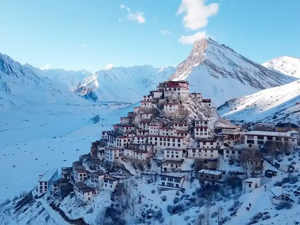
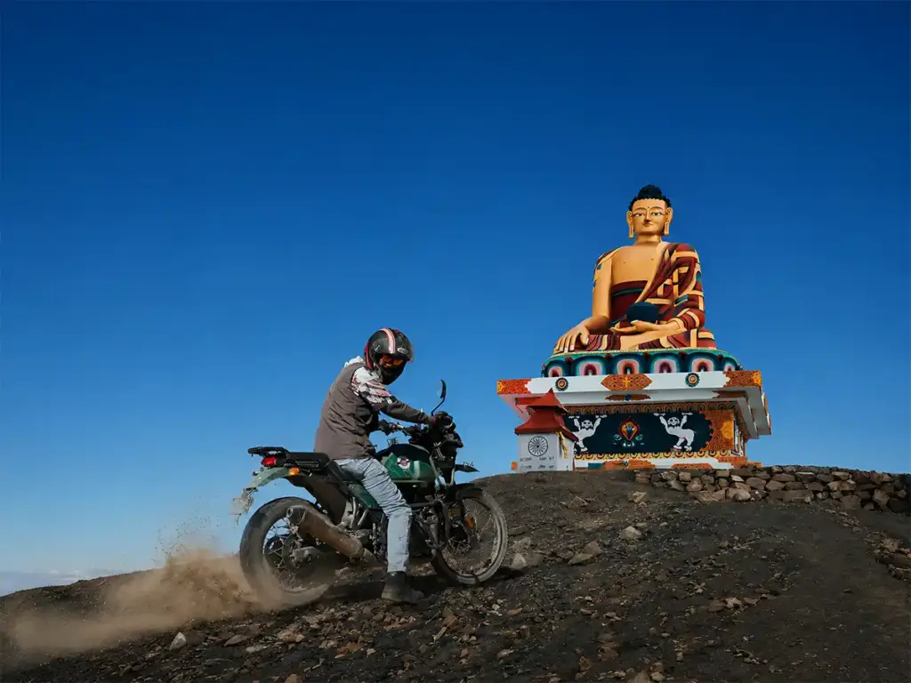
Buddha statue in Langza overlooking the Spiti Valley.

How to Reach Spiti Valley from Delhi – Complete 2026 Guide

You’ve been dreaming about Spiti Valley for months to see the raw and rugged mountains as dramatic as Ladakh, ancient monasteries like Tabo and Dhankar, and clear blue skies that seem to go on forever. But every time you search for how to get there from Delhi, you land on blogs that contradict each other or quote roads that are closed. We get it. And we’re fixing that right now. By the time you finish reading this, you’ll know exactly how far Spiti Valley is from Delhi, which route suits you best, the costs involved, and a 7-day itinerary you can follow without second-guessing yourself. Everything you need is right here, in one place. Delhi to Spiti Valley Distance & Routes The distance from Delhi to Spiti Valley sits at roughly 700–770 km, depending on which route you choose. There’s no shortcut and you have to either drive through Shimla or Manali to reach Kaza. Both roads climb deep into the Himalayas and can be little challenging for first-timers. Recommended duration to reach Spiti from Delhi should be two or three days because it’s the smarter, safer way to arrive feeling good rather than completely exhausted. Routes to Reach Spiti Valley from Delhi Route 1: Via Shimla (Recommended) The most suitable route- Delhi–Shimla-Kaza-Manali is the one you can trust. Covering approximately 700 km over 2–3 days via NH5, the road eases you in gently — Along the way, you pass through some genuinely beautiful places like Shimla, get to see apple orchards of Narkanda, streets of Rampur, and cross the dangerous but one of the most scenic route- Indo-Tibet Highway. Each stop feels different from the last. Reckong Peo comes next, and then finally Kaza. The gradual altitude gain significantly reduces Acute Mountain Sickness (AMS) risk, road conditions remain reliable throughout, and unlike the Delhi to Spiti Valley by Manali route, this highway stays open year-round. Route 2: Via Manali (Scenic & Adventurous) For experienced drivers and adventure seekers, the Delhi to Spiti Valley via Manali route delivers the kind of road trip stories you’ll tell for years. Covering approximately 750 km over 2–3 days, the road takes you through Manali’s pine-covered valleys, the engineering marvel of the Atal Tunnel, the rugged high-altitude plains of Gramphu, and the legendary Kunzum Pass (4,551 m) before descending into Kaza. Open only from June to October, this route demands driving confidence but rewards you with the most dramatic, adrenaline-charged entry into Spiti Valley imaginable. Pro Tip: Always verify road status on the HRTC website if you’re travelling from Manali route. Delhi to Spiti Valley by Car Travelling by car from Delhi to Spiti Valley is the most popular option — it gives you complete control over pace and stops. A 4-Wheel Drive or high-clearance SUV (Thar, Scorpio, Fortuner, Innova Crysta, Jimny) is strongly recommended. Sedans are not suitable beyond Nako on the Shimla route or on Kunzum Pass. The cost of fuel of the whole Spiti Trip will be between ₹6,000 to ₹12,000  Pro Tip: Choose Shimla route while going and Manali while returning for a complete circuit. Delhi to Spiti Valley by Volvo Bus The Delhi to Spiti Valley Volvo bus is the go-to for budget solo travellers. You can take a Volvo bus from Kashmiri Gate which takes about 8-9 hours approximately to reach Shimla. Generally the buses start operating in the evening. Another option is taking a direct bus to Rampur and then taking a local bus to Reckong Peo from where you can find a bus to Kaza.Volvo bus prices starts from ₹1,000 to ₹2,000 Delhi to Spiti Valley by Train There is no direct Delhi to Spiti Valley train — the valley has no rail connectivity. The closest railway station is Shimla. However, the train ride has beautiful views all the way to Shimla, passing through alpine dense forest and then proceeding your trip by road from Shimla.Train tickets prices varies from ₹200 to ₹1,500 Perfect 7-Day Spiti Valley Itinerary from Delhi FAQs: Delhi to Spiti Valley Q. How many days does it take to reach Spiti Valley from Delhi? Ans. A minimum of 2 days of travel is required to reach Kaza (Spiti’s main town) from Delhi. Most travellers take 3 days to allow for acclimatisation stops. Q. Which is better — the Shimla route or Manali route to Spiti? Ans. For first-timers, the Shimla route is safer and open year-round. The Manali route is more dramatic but open only from June to October, and Kunzum Pass demands driving experience. Q. Is Spiti Valley safe for solo travellers? Ans. Yes. Spiti is one of India’s safest travel destinations. Solo female travellers also report positive experiences. Q. Do I need a permit for Spiti Valley? Ans. Indian nationals do not need a permit. Foreign nationals need an Inner Line Permit (ILP), available online or at the SDM office in Reckong Peo. Q. Network connectivity in Spiti Valley? Ans. BSNL, Jio and Airtel have the best coverage in Spiti, including in Kaza. Some places do have weak signals but overall the connectivity is good and getting better. Q. Can I visit Spiti Valley in winter? Yes, but only via the Shimla route. Temperatures drop to -30°C and roads beyond Nako become treacherous. It’s Ans. recommended only for experienced cold-weather travellers.

How to Reach Spiti Valley from Delhi – Complete 2026 Guide Read More »