All Blogs

Find all your answers here about the destinations you want to visit, how to visit, when to visit, and what itinerary to follow.

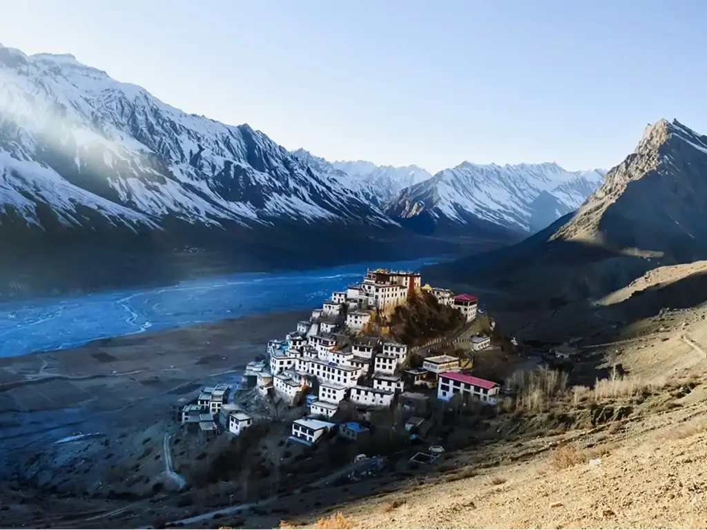
Key Monastery at 4,166 m above the braided Spiti river, snow-covered Himalayan peaks in the background

Spiti Valley Itinerary: Complete 7 and 10 Day Plan for Summer and Winter (2026)

What is the best Spiti Valley itinerary? A 9-day Spiti Valley circuit from Delhi enters via Shimla and Kinnaur, spends 3 nights in Kaza, and exits via Chandratal and Manali. Key stops are Reckong Peo (night 2), Nako (night 3), Tabo and Dhankar (day 4), Kaza as base (nights 4 to 6), Chandratal (night 7), and Manali (night 8). The winter itinerary follows the Shimla route only, takes 6 to 7 days, and focuses on Kaza, Key Monastery, and Kibber for snow leopard sightings. Most Spiti Valley itineraries online are written by people who have researched the route, not stood at Kunzum La at 7 AM when the first light touches the passes and your hands are too cold to hold a camera but you cannot stop smiling. This Spiti Valley itinerary guide is different. The altitude numbers here are the same as everywhere else. The distances look reasonable too. And then you actually get there and realize the 50 km between Nako and Tabo feels completely different from any 50 km you have driven before, because the Malling Nala section will make you grip the steering wheel with both hands while the Spiti River moves 400 metres below your tyres. That gap between what an itinerary says and what a route actually feels like is the difference between a trip that lands well and one that catches you off guard at 14,000 feet with a headache and a budget that ran out in Kaza. This guide closes that gap. It covers the summer circuit in full, the winter version in honest detail, and the specific things each day asks of you physically and logistically, not just where you go but why you go there in that order. For context on when each of these itineraries actually works and what crowd levels look like month by month, The Travel Story’s Spiti Valley seasonal guide is built from on-ground experience across every month of the calendar year. What to Know Before Planning Your Spiti Valley Itinerary Fact 1: Spiti has two different road seasons, and they determine everything. The Shimla-Kinnaur route stays open year-round for most stretches, though winter requires a 4WD and careful road monitoring. The Manali route via Kunzum Pass (4,551 m) is open only from late May to mid-October. This means your circuit options are: Fact 2: The Shimla route is the correct first-timer route — not the Manali route. The Shimla route gains altitude gradually over 2 to 3 days: Narkanda at 2,700 m, Reckong Peo at 2,670 m, Nako at 3,625 m, then Kaza at 3,800 m. Your body adjusts in stages. The Manali route via Kunzum Pass pushes you from Manali at 2,050 m to Kaza at 3,800 m in a single driving day. That speed of ascent is the most common reason first-time visitors arrive at Kaza with a splitting headache and spend their first full day doing nothing useful. The 9-Day Spiti Valley Itinerary: Full Summer Circuit (Shimla In, Manali Out) This is the route that delivers the most variety, the most landmarks, and the most efficient circuit without backtracking. Shimla in, Manali out, with Chandrataal on the final stretch. For travellers who want this exact circuit managed end to end with a trip captain, backup vehicle, and accommodation pre-booked at each stop, The Travel Story’s Spiti with Chandrataal package runs weekly batches from June through September at Rs 17,999 per person. Day 1: Delhi to Shimla (350 km, 8 to 9 hours) Leave Delhi by 5 AM. The road to Shimla via Chandigarh runs on National Highway 5 and is mostly expressway until Kalka, where the hill road begins. Arrive in Shimla by early afternoon, check in, and sleep early. This is a transition day. Do not try to push further. You are crossing from the plains into the foothills, and the altitude of Shimla at 2,220 m is a useful first step in acclimatization. If leaving Delhi by overnight Volvo from ISBT Kashmiri Gate, you arrive in Shimla in the morning and can proceed directly to Narkanda on the same day, effectively combining Day 1 and Day 2. Overnight: Shimla or Narkanda Distance: 350 km Altitude gain: 216 m (Delhi) to 2,200 m (Shimla) Day 2: Shimla to Sangla Valley or Reckong Peo via Kinnaur (230 to 280 km, 8 to 10 hours) This is where the journey becomes genuinely different. Leave Shimla by 6 AM. The road follows the Hindustan-Tibet Highway along the Sutlej River gorge through Rampur and into the Kinnaur district. From Karcham, you have a choice: detour into Sangla Valley (and optionally Chitkul, India’s last inhabited village on the Indo-Tibet border), or continue straight to Reckong Peo. The Sangla-Chitkul detour adds 60 km round trip but delivers your first look at the river colors and stone architecture that characterize this part of Himachal. If you have the day, make the detour. If you are running to a tighter schedule, proceed to Reckong Peo and detour to Kalpa for the sunset view of the Kinner Kailash range directly across the valley. Fill your fuel tank completely in Reckong Peo. There is no petrol pump between Reckong Peo and Kaza on the Shimla-Kinnaur route. Overnight: Reckong Peo or Sangla (for the Chitkul detour) Distance: 230 to 280 km depending on detour Altitude gain: 2,200 m to 2,670 m Day 3: Reckong Peo to Nako via Khab Sangam (80 km, 4 to 5 hours) Short distance, long experience. The road from Reckong Peo descends to Khab Sangam, where the Spiti River meets the Sutlej River in a confluence visible from the road above. The two rivers are noticeably different in color at this point, green-grey Spiti joining the brown Sutlej, and the sight is one of those genuinely underrated stops that people who rush past always regret. Past Khab, the road crosses the Pooh bridge and begins the climb toward Nako. The Malling Nala section sits roughly 20 km before Nako and is the most unstable stretch on the

Spiti Valley Itinerary: Complete 7 and 10 Day Plan for Summer and Winter (2026) Read More »
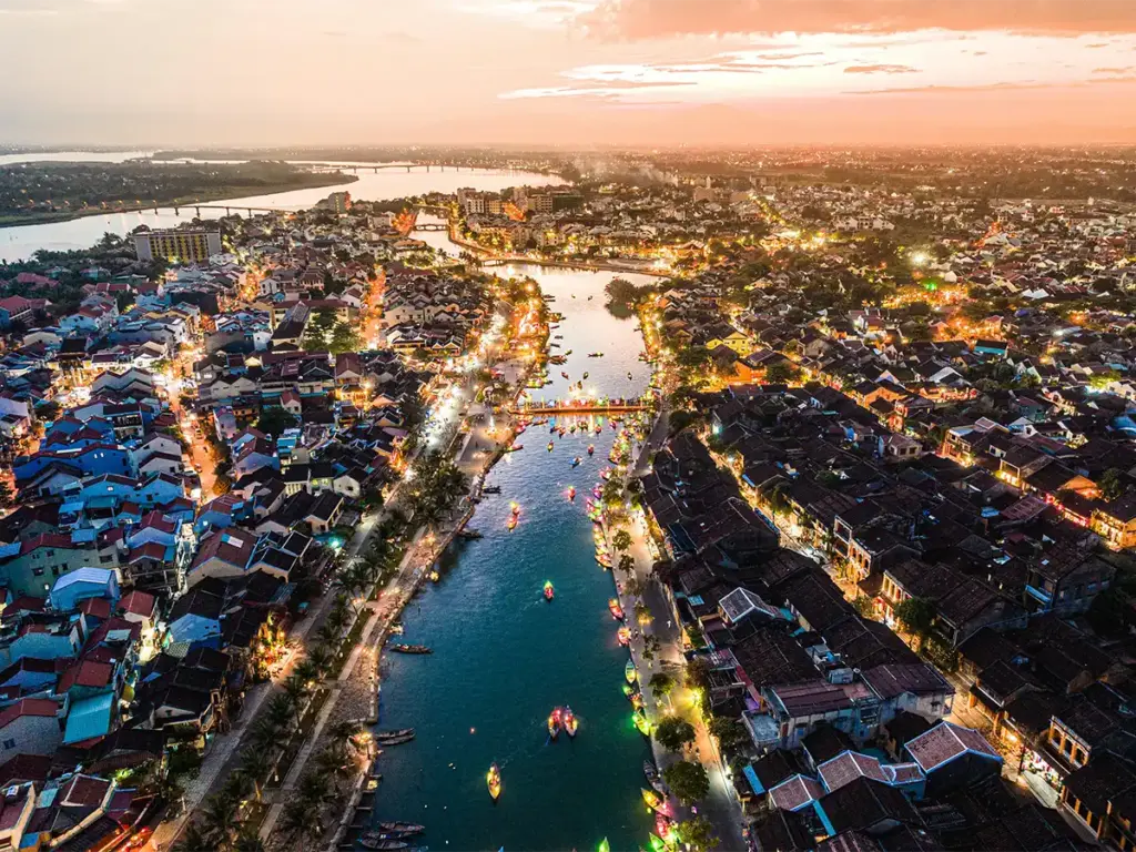
Aerial dusk view of Hoi An, Vietnam, with the Thu Bon River, lantern boats and the town lighting up at sunset

Vietnam vs Thailand for Indians: The Honest 2026 Comparison

Quick Answer: Vietnam is better value for Indian travellers in 2026. Vietnam’s e-visa costs $25 for 90 days with multiple entry, while Thailand reinstated visa fees for Indians in 2026. A 7-day Vietnam trip from India costs Rs 50,000 to 90,000 compared to Rs 60,000 to 1,20,000 for Thailand. Vietnam wins on value, safety, and cultural depth. Thailand wins on nightlife, beach infrastructure, and flight availability. For years, Bangkok was the first word that came to mind when an Indian traveler said “international trip.” Thailand made sense. Visa was easy, flights were cheap, beaches were good, street food was everywhere, and enough of your friends had already been that you knew exactly what to expect. That comfort zone worked for a long time. Here is what has changed: Thailand is no longer the frictionless option it was. In 2026, Thailand reinstated visa fees for Indian passport holders after a brief visa-free arrangement. Vietnam, in the same window, rolled out a seamless online e-visa system: $25, 90 days, multiple entry, approved in three working days. Two policy changes in opposite directions. The result is a genuine shift in how Indian travellers are planning their Southeast Asia trips and the numbers are showing it. This is not an argument that Thailand is bad. It is a detailed, data-backed comparison of Vietnam vs Thailand so that the right trip gets made for the right person. For travellers who are already leaning toward Vietnam, the Vietnam destination guide at The Travel Story covers routes, packages, and what to expect across the country. The 2026 Shift: What Actually Changed The Thailand that dominated Indian travel itineraries for a decade was driven by one thing: low friction. No visa cost, well-established tourism infrastructure, flights from every major Indian city, and a reputation that practically marketed itself. Two things disrupted that: Thailand reinstated visa charges for Indians in 2026. Depending on the visa category and processing mode, this adds Rs 2,500 to 4,000 per person to every trip. For a couple, that is Rs 5,000 to 8,000 before a single flight is booked. For a family of four, the number climbs faster. The convenience factor — which was always Thailand’s strongest argument — took a direct hit. At the same time, Vietnam’s e-visa situation became genuinely excellent. The application takes 15 minutes online at the official portal, approval comes in 3 working days, the fee is $25 (approximately Rs 2,100), and the visa gives 90 days with multiple entries. That is more flexibility than most Indian travellers will ever need. Vietnam also expanded direct flight routes from Delhi, Mumbai, and Bengaluru through IndiGo, Vietnam Airlines, and VietJet, which removed the last logistical argument for choosing Thailand on convenience grounds. The result is that Vietnam now wins on every metric that previously belonged to Thailand: lower cost, simpler visa, more authentic crowd levels, and a destination that still feels fresh rather than familiar. Vietnam vs Thailand: Side-by-Side Comparison Category Vietnam Thailand Visa (Indians, 2026) e-Visa, $25, 90 days, online in 3 days Visa required, Rs 2,500-4,000 per person Daily budget (mid-range) Rs 3,500 to 6,500 Rs 5,000 to 9,000 7-day trip cost from India Rs 50,000 to 90,000 Rs 60,000 to 1,20,000 Flight from Delhi (return) Rs 12,000 to 22,000 Rs 10,000 to 18,000 Street food meal Rs 150 to 400 Rs 300 to 700 3-star hotel per night Rs 2,000 to 4,000 Rs 3,000 to 6,000 Safety for solo travellers Very high High (scams more common) Nightlife Growing, different scale Unmatched in Southeast Asia UNESCO Heritage Sites 8 6 Best beach Phu Quoc, Nha Trang Phuket, Koh Samui, Phi Phi Food for vegetarians Challenging More options (Buddhist influence) Crowd level 2026 Moderate High to very high Visa: Vietnam Wins Clearly in 2026 Vietnam’s e-visa is currently one of the most streamlined entry systems for Indian passport holders anywhere in Southeast Asia. The application is completed entirely online at the official Vietnam Immigration Department portal. Documents required: a scan of the passport data page and a passport-size photograph. Processing takes 3 working days. The visa permits 90 days of stay with multiple entries, which means travellers can cross into Cambodia or Laos and re-enter Vietnam without a new application. Thailand’s situation shifted in 2026. After ending its temporary visa-free arrangement for Indians, Thailand moved back to a visa requirement. The fee and process depend on the type of visa being applied for, but the additional cost of Rs 2,500 to 4,000 per person is now a fixed line item on every Thailand trip budget. For Indian families traveling in groups of four or more, this adds up quickly enough to change the destination calculus. Verdict: Vietnam wins on visa. The cost difference is meaningful, the process is simpler, and the 90-day duration gives more flexibility than any Thailand visa category available to Indian travellers at comparable cost. Budget Breakdown: Vietnam vs Thailand in Rupees The most consistent finding from travellers who have done both destinations in recent years is that Vietnam runs 15 to 35 percent cheaper than Thailand for a comparable experience. Here is what that looks like in actual numbers: Daily Budget: Vietnam Daily Budget: Thailand A 7-day Vietnam trip from Delhi including return flights, accommodation, food, and activities runs Rs 50,000 to 90,000 per person. The same 7-day Thailand trip runs Rs 60,000 to 1,20,000. The gap widens for families and groups because it compounds across more people. Flights from India: Vietnam vs Thailand Thailand still has a slight edge on flight costs from most Indian cities, particularly for last-minute bookings. Bangkok and Phuket are served by more carriers from more Indian cities than Hanoi or Ho Chi Minh City. However, the difference when booked 3 to 4 weeks in advance is typically Rs 2,000 to 4,000 per person. Against the visa saving of Rs 2,500 to 4,000 that Vietnam offers, the flight cost advantage of Thailand largely cancels out. For a couple traveling to Vietnam vs Thailand in 2026, the net cost difference

Vietnam vs Thailand for Indians: The Honest 2026 Comparison Read More »

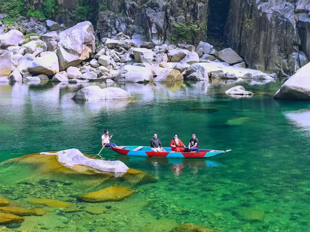
From the Double Decker Root Bridge to Dawki's glass river and Nohkalikai Falls, here are the 10 best places in Meghalaya — with real distances, tips, and what to expect.

Best Places to Visit in Meghalaya: 10 That Actually Earn the Journey

What are the best places to visit in Meghalaya? Meghalaya’s top places to visit include Shillong (the capital), Cherrapunji’s waterfalls (Nohkalikai at 340 meters and Seven Sisters Falls), the crystal-clear Dawki river, Mawlynnong (Asia’s cleanest village), the Double Decker Living Root Bridge at Nongriat (3,500 steps from Tyrna), Laitlum Canyon, Krang Suri Waterfall in Jaintia Hills, Mawsmai Cave, and Mawsynram. A 5 to 7 day trip covers the essential circuit from Guwahati. There is a specific moment in Meghalaya when you understand why you came. It is not at the viewpoint or at the tourist board signpost. It happens mid-morning on the Shillong to Cherrapunji highway when a cloud rolls in and passes through the car window, and for about thirty seconds you are driving inside a cloud at 5,000 feet with zero visibility and everything smells like rain that has been falling for a thousand years. That moment exists in Meghalaya in a way it does not exist anywhere else in world. The state has the world record for annual rainfall, communities that grew tree roots into bridges over two centuries, a river so clear that boats appear to float on air, and a village that won the title of Asia’s cleanest. These are not tourism slogans. They are verified, documented facts, and they are all within four hours of each other. This guide covers the ten best places to visit in Meghalaya with real distances, practical timings, and what each place actually delivers to a traveller who has made the journey. If you are also planning to visit Meghalaya this year then take a look on our upcoming batches. The Travel Story will handle all the logistics and a local captain that will keep everything sorted throughout the trip What Makes Meghalaya Different from Every Other Hill Destination Most Indian hill destinations offer either scenery or culture. Meghalaya offers both but through a framework that is found nowhere else: a matrilineal Khasi society that has been managing its forests, rivers, and community spaces with environmental practices that most modern governments are still trying to legislate. The sacred forests that have been protected for over 1,000 years, the living root bridges that were grown over 180 years because stone bridges could not survive the rainfall, and the river that local communities kept clean long before eco-tourism was a term are not manufactured tourist attractions. They are the side effects of a culture that took its geography seriously. Understanding this makes every place on this list more interesting than the photograph alone suggests. The 10 Best Places to Visit in Meghalaya 1. Shillong Distance from Guwahati: 98 km (approximately 2 to 3 hours by road) Shillong is the entry point for most Meghalaya trips and worth more than the standard one-day stopover most itineraries give it. The city sits at 1,496 metres in the Khasi Hills and has the character of a colonial hill station that was never properly sanitized for mass tourism. Ward’s Lake in the city centre, with its pedestrian bridge and morning mist, is the place to start early. Elephant Falls, a three-tiered waterfall 12 km from the city, runs strongest from June to October. Shillong Peak at 1,965 metres is an IAF station that offers the best panoramic view of the city, weather permitting. Don Bosco Museum in Mawlai is the most underrated thing in Shillong: seven floors covering the culture, art, history, and language of the Northeast, with some of the best curation in the country. Most travelers skip it entirely and come back wishing they hadn’t. Best time: October to March for clear weather. June to September for the city’s musical energy and lower prices. 2. Cherrapunji (Sohra) Distance from Shillong: 55 km (approximately 2 hours) Cherrapunji, known locally as Sohra, holds the world record for the most rainfall ever measured in a single calendar month: 9,296 mm in July 1861. That number is not just a record. It is the reason every waterfall, every cave, and every piece of landscape around Cherrapunji looks the way it does. The viewpoint at Eco Park above the falls overlooks the Bangladesh plains 1,300 metres below. On clear mornings, the visibility extends over 100 km into the plains. On monsoon days, clouds fill the valley below the viewpoint and you are looking down at the top of a weather system. Mawsmai Cave, 6 km from Cherrapunji town, is the only cave in the region easily accessible without a guide. The limestone formations inside have been shaped by 11,000 mm of annual rainfall and look exactly like what happens when water has been moving through the same rock for 50,000 years. Best time: June to September for the waterfalls. October to March for clear views and cave exploration. 3. Nohkalikai Falls Location: 8 km from Cherrapunji town India’s tallest plunge waterfall drops 340 metres into a pool whose colour changes with the season. In monsoon, the pool turns milky turquoise from the mineral content of the water combined with the force of the fall. In dry season, the same pool sits aquamarine and still, and the waterfall above it is a white thread on a cliff face. The difference between Nohkalikai in July and Nohkalikai in January is the difference between a river and a photograph of a river. Most travel photographs of Nohkalikai were taken in monsoon. Most tourists visit in December. These are not the same experience. For a complete breakdown of how each season changes what Meghalaya’s places look like, the best time to visit Meghalaya guide explains every month honestly. Practical note: Entry to the viewpoint is covered under the Eco Park entry fee. 4. Seven Sisters Falls (Nohsngithiang Falls) Location: 1 km from the main Cherrapunji market road Seven Sisters Falls is 315 metres high and 70 metres wide. It is seasonal: from November to May, it ranges from minimal to absent. From June to October, it runs fully across all seven streams and produces a volume of falling water that is

Best Places to Visit in Meghalaya: 10 That Actually Earn the Journey Read More »

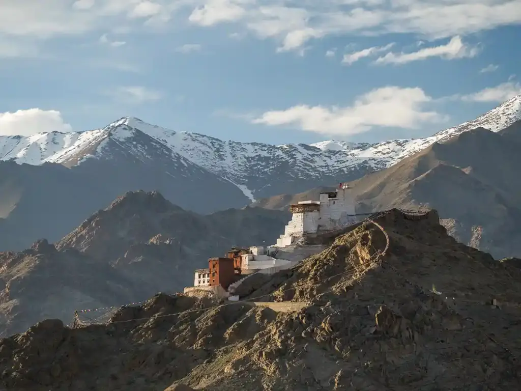
Namgyal Tsemo Monastery and Fort perched on a ridge above Leh, with snow-capped peaks behind

How to Reach Ladakh from Delhi: Every Route Compared for 2026

Quick Answer: Delhi to Ladakh (Leh) is 1,026 km by road via Manali and 1,050 km via Srinagar. By flight from Delhi, Leh is 1.5 hours away. There is no direct train to Leh; the nearest station is Jammu Tawi, 663 km from the city. HRTC buses run from Delhi ISBT Kashmiri Gate and take approximately 30 to 33 hours. Road travel takes 2 to 3 days with an overnight stop at Jispa or Keylong. Ladakh sits at the northern edge of India, separated from the rest of the country by some of the highest mountain passes in the world. Getting there from Delhi is not a single decision. It is a series of decisions: how much time you have, whether the journey itself is part of the experience you are looking for, what budget you are working with, and which season you are traveling in. The answer is different for every traveler. This guide covers all five realistic ways to reach Ladakh from Delhi. Each one is explained with the actual distances, costs, and conditions that matter in 2026. Two of them involve flying. Three involve roads. All of them have trade-offs that are worth understanding before you book anything. Once you have settled on a route, the Ladakh destination guide covers what the region holds once you are there — the lakes, the passes, the circuits, and what each part of Ladakh is actually like. For travelers who want the Ladakh experience fully planned, including transfers and accommodation across the circuit, The Travel Story’s Leh Ladakh Full Circuit handles the logistics from Delhi to Leh and back with group departures through the season. The Quick Comparison: All Five Routes at a Glance Mode Distance Time Approx Fuel Cost (One Way) Season Flight (Delhi to Leh direct) ~620 km air 1.5 hours Rs 8,000 to 15,000 per ticket Year round Road via Manali ~1,060 km 2 days Rs 11,500 to 14,500 fuel (SUV, 10 kmpl) Late May to mid-October Road via Srinagar ~1,320 km 2 days Rs 14,500 to 18,000 fuel (SUV, 10 kmpl) May to November Train + Road 580 km train + 700 km road 2.5 to 3 days Rs 1,200 to 1,800 train + road costs Year round (train); season-dependent (road) HRTC Bus Delhi to Leh ~1,026 km 30 to 33 hours Rs 2,500 to 3,500 per person June to September Route 1: By Flight from Delhi to Leh Time: 1.5 hours Cost: Rs 8,000 to 15,000 one way in regular season; Rs 15,000 to 25,000 in peak June to August Airport: Kushok Bakula Rimpochee Airport, located 9 km from Leh city centre Flying is the fastest way to reach Leh and the only option that works in winter when road routes are closed. IndiGo, Air India, SpiceJet, and GoFirst all operate the Delhi to Leh route, with multiple daily departures in season. The airport is a joint civil-military terminal and security is thorough; carry a printed copy of your ticket and ID. The one critical consideration for people flying into Leh is altitude. Leh sits at 3,500 metres above sea level. Arriving by flight means your body goes from sea level to high altitude in 90 minutes with no gradual adjustment. Spend the first day in Leh doing nothing strenuous. Eat light, drink water, avoid alcohol, and resist the urge to immediately head to Pangong or Nubra. Altitude sickness after flying in is common and manageable, but only if you treat the first day as a rest day. Who should fly: Travelers with 7 days or fewer. First-time Ladakh visitors who want to maximize time in the region rather than spending 4 days on the road. Anyone traveling outside the May to October road season. Route 2: Delhi to Leh via Manali (The Manali-Leh Highway) Total distance from Delhi: Approximately 1,026 km Manali to Leh segment: 427 km via the Atal Tunnel Recommended time: 2 days with an overnight stop at Jispa or Keylong Season: Late May to mid-October (governed by Baralacha La snow clearance) This is the route that most road-trip travelers take and the one that most defines the overland Ladakh experience. The journey breaks down into two distinct days. Day 1: Delhi to Jispa or Keylong (530 to 560 km) Leave Delhi by 5 AM to clear city traffic before 7 AM. The road runs via Chandigarh and then climbs through Kullu and Manali before the Atal Tunnel takes over from the old Rohtang Pass route. The Atal Tunnel, opened in 2020, is 9.02 km long at 3,060 metres and bypasses the traffic and weather delays that once defined the Rohtang crossing. It saves 46 km of distance and 2 to 3 hours of time. After the tunnel, the road enters the Lahaul Valley and follows the Chandra River through Sissu and Tandi before reaching Keylong (the headquarters of Lahaul and Spiti district) and then Jispa, a small village that functions as the standard overnight stop. Note the fuel situation here: the last reliable fuel stop before Leh is Tandi, near Keylong. Fill up completely before leaving Tandi regardless of how much is in the tank. Day 2: Jispa to Leh (approximately 370 km) This is the day that justifies the entire road trip. The route crosses four high mountain passes in sequence. Baralacha La at 16,047 feet is the first major test, usually reached by mid-morning. Near the summit, Suraj Tal sits at 16,500 feet, one of the highest lakes in India and worth a 15-minute stop. The road then descends to Sarchu, a camp settlement at 14,000 feet that functions as a rest stop rather than an overnight destination for most travelers. After Sarchu, the Gata Loops begin: 21 hairpin bends climbing from the valley to the Nakee La and Lachulung La passes. The road surface here has some rough patches and the altitude gain is rapid. The More Plains beyond Lachulung La are where Tibetan wild asses (kiangs) are regularly spotted walking alongside or across the road. The

How to Reach Ladakh from Delhi: Every Route Compared for 2026 Read More »

Performers on a gondola boat during an evening fountain show at Grand World Phu Quoc

Best Time to Visit Phu Quoc: A Month by Month Guide for 2026

What is the best time to visit Phu Quoc? The best time to visit Phu Quoc is between November and April, during the dry season, when temperatures average 27 to 30°C, seas are calm, and rainfall is minimal. December to February offers the most consistently clear conditions. March stands out as the sweet spot — dry-season weather with noticeably lower prices as European holiday demand drops. The wet season runs May to October, with July and August seeing the heaviest rainfall of 350 to 400 mm monthly. Phu Quoc sits in a quiet corner of the Gulf of Thailand, roughly 45 kilometres off the Cambodian coastline, and it does not follow the same weather rules as the rest of Vietnam. That matters more than most travel guides acknowledge. When typhoons batter Da Nang in October and flooding closes roads around Hoi An in November, Phu Quoc is entering its best season. When central Vietnam is finally dry and warm in February, Phu Quoc has already been sunny for three months. If you are planning a Vietnam trip and Phu Quoc is on the list, knowing this distinction will completely change how you sequence your itinerary. The island rewards travellers who plan around its specific climate rather than assuming all of Vietnam follows one seasonal pattern. For those building a full Vietnam trip that includes Phu Quoc alongside Hanoi, Ha Long Bay, and Hoi An, the Exotic Vietnam trip by The Travel Story covers the full circuit with timing planned around each region’s best conditions. If you want to understand Vietnam’s seasonal geography more broadly before deciding, the Vietnam destination guide is a good starting point. This guide goes month by month through Phu Quoc’s weather, explains what to do in each season, and gives you the specific windows that most other articles either oversimplify or miss entirely. Why Phu Quoc Runs on a Different Weather Calendar Phu Quoc’s climate is controlled by the southwest monsoon, which is the opposite of what governs the Vietnamese coast from Da Nang northward. The island sits on the western side of Vietnam, sheltered from the northeast monsoon that soaks central Vietnam from September through December. The practical result is this: Phu Quoc’s rainy season peaks in July and August, while the beach season runs from November through April. Compare that to Hoi An, where July is gloriously sunny but November brings floods. These two places are in the same country but on completely opposite seasonal calendars. A traveler who plans their trip around one without accounting for the other will spend at least part of their Vietnam trip in the wrong place at the wrong time. One more fact worth knowing upfront: Phu Quoc is largely sheltered from Vietnam’s typhoon belt. The major storms that cause serious disruption along the central coast rarely reach the island. This makes Phu Quoc a more weather-reliable destination than much of the country, even during the wet months. Month by Month: What Phu Quoc Actually Looks Like Month Avg Day Temp Rainfall Sea Conditions Crowd Level Price Level November 30°C Low (80-100mm) Calm, improving Building Low-medium December 27-29°C Very low Calm, clear High High January 27-29°C Very low Calm, excellent High High February 28-30°C Very low Calm, excellent Medium-high High March 30-32°C Very low Calm Medium Medium (sweet spot) April 31-33°C Low, increasing Slightly choppy Low-medium Medium May 30-32°C Moderate (150mm) Rougher Low Low June 29-31°C Heavy (300mm+) Variable Low Low July 29-31°C Peak (350-400mm) Rough Very low Lowest August 29-31°C Peak (350-400mm) Rough Very low Lowest September 29-30°C Decreasing Improving Low Low October 28-30°C Low-moderate Calming Low-medium Low The Peak Season: December to February December through February is the most reliably excellent period on the island. Daytime temperatures sit between 27 and 30°C with humidity that feels genuinely manageable rather than oppressive. The sea around Phu Quoc clears to a pale turquoise that makes the An Thoi Archipelago look like something from a travel magazine. Snorkeling around Gam Ghi Islet, where coral reefs sit close to the surface in shallow, calm water, is at its cleanest during these months. The world’s longest sea-crossing cable car, stretching 7,899 metres from An Thoi to Hon Thom Island at 174 metres above the water, operates in full sunshine with unobstructed views of the Gulf below. The honest downside is straightforward: this is the most expensive and most crowded period of the year. Hotels at Sao Beach, considered the island’s most beautiful stretch of white sand, sell out weeks ahead during Christmas and New Year. The Dinh Cau Night Market in Duong Dong town, worth visiting for the grilled seafood and the noise and the general good feeling of it all, gets genuinely packed on peak evenings. If you want December or January, book early. If you can move your dates at all, the third week of January through February is a slightly softer window. European school holidays wind down after the first two weeks of January, which brings both availability and slightly lower rates while the weather remains identical. The Sweet Spot Most Guides Underrate: March March is the month experienced travellers circle on their calendars and most first-time visitors overlook. The weather is dry and clear. Temperatures creep slightly higher toward 30 to 32°C, but Phu Quoc’s persistent sea breeze along Long Beach keeps this comfortable. The sea is still calm and clear enough for the An Thoi snorkeling boats to run their full routes. Sao Beach has returned to the quiet, unhurried version of itself that photographs so well in the morning light. What changes in March is the demand. European holiday travel has largely wrapped up, and the next wave of visitors, mainly Southeast Asian travellers during local public holiday periods in April, has not yet arrived. Accommodation rates at good mid-range properties drop noticeably from their December to January peaks, and restaurants have the space and time to actually be good rather than just fast. The first three weeks of March specifically represent the best

Best Time to Visit Phu Quoc: A Month by Month Guide for 2026 Read More »

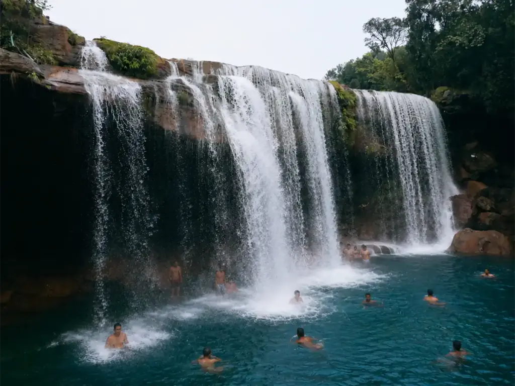
Krang Suri Waterfall in Meghalaya with turquoise pool and people swimming at the base

Best Time to Visit Meghalaya: Why July Is the Answer Nobody Expected

Quick Answer: June to September is when Meghalaya is at its most dramatic. Waterfalls including the 340-metre Nohkalikai Falls and the seasonal Seven Sisters Falls reach full capacity only during this window. July brings the heaviest rainfall, coolest temperatures between 18°C and 24°C, and the lowest crowd density of the year. For clear skies and dry trails, visit October to February. Most people who want to visit Meghalaya put it off. They look at the calendar, see July, see the word “monsoon,” and decide to wait for a better season. They come back in December or March, when the skies are clear and the roads are reliable, and they see a very beautiful place. What they do not see is Meghalaya alive. July is when Meghalaya becomes what its name actually means. The word comes from Sanskrit: “megha” for cloud, “alaya” for abode. The Abode of Clouds. In December, that name is poetic. In July, it is a physical description of where you are standing. The clouds do not stay above you. They move through you, wrapping around hillsides, filling valleys, cutting visibility to fifty metres and then clearing to reveal a green so dense and layered that it genuinely does not look like a photograph. Meghalaya in monsoon season is the state as it was meant to be experienced, and for travellers who want to understand what that looks like before booking, The Travel Story runs a dedicated Monsoon Meghalaya trip that covers the main circuit without the logistical problems that solo monsoon travel in the Northeast can create. Why Meghalaya Is a Different Kind of Monsoon Destination Every monsoon travel guide in India tells you the same thing. Go to Ladakh. Go to Spiti. Go somewhere in the Himalayan rain shadow where it stays dry. That is genuinely good advice for most of India. Meghalaya is the one place where that advice is completely wrong. Mawsynram, a village in the East Khasi Hills, holds the world record for highest average annual rainfall at 11,873 mm. The nearby town of Cherrapunji, locally called Sohra, averages 11,430 mm per year and holds an entirely separate record: the most rainfall ever recorded in a single calendar month, which was 9,296 mm in July 1861. These are not marketing numbers. They are measured figures from the India Meteorological Department and recorded by Britannica and multiple scientific sources. The reason these numbers exist is the geography. Moisture-laden winds from the Bay of Bengal travel north and hit the southern escarpments of the Khasi Hills at full force. The air rises, cools rapidly, and dumps its water in what scientists call orographic rainfall. The result is a hillside that receives more rain than almost any other place on earth, concentrated almost entirely between June and September. Between 70 and 90 percent of Meghalaya’s annual rainfall falls in this four-month window. For the traveler, this means one thing: if you want to see what Meghalaya actually is, you need to be there when the rain is. Month by Month: What Meghalaya Looks Like Through the Year January and February The skies are clear and the temperature drops to around 5°C at night in higher areas like Shillong. The hills are green but quieter. Waterfalls are at their lowest flow of the year, and some are barely visible. The trails to the Living Root Bridges are dry and manageable. This is the period most Indian tourists choose, so crowds at popular spots are at their highest. A good time to visit if you want comfortable conditions. Not the time if waterfalls are what you came for. March and April Warmer, with the first pre-monsoon showers beginning in April. Rhododendrons bloom in the hills. Waterfalls start to return slowly. The crowds from the peak winter season have thinned out. A reasonable shoulder period that gets underrated because it sits between the two popular windows. May The monsoon is building. Humidity climbs. Some waterfalls return to partial flow. The temperature stays comfortable at 15°C to 20°C. Rain becomes more regular. This is actually a good time for travelers who want the green and the beginning of waterfall season without the intensity of peak monsoon. Road conditions are still reliable. June The monsoon arrives properly. The landscape shifts visibly week by week. Waterfalls begin to reach serious capacity. The Seven Sisters Falls, which runs nearly dry from October to May, starts to come back. Fewer tourists than peak season but more than July and August. Weather is unpredictable and heavy rain is possible on any day. July: The Real Answer This is the month most travel blogs tell you to avoid. It is also, by a significant margin, the most extraordinary time to be in Meghalaya. The Nohkalikai Falls, at 340 metres the tallest plunge waterfall in India, is thundering. Not flowing. Thundering. The roar is audible before the falls are visible. The pool at the base turns a milky turquoise from the mineral content of the water mixed with the force of the fall. In May, that same waterfall is a thin white line on a cliff face. The Seven Sisters Falls is running fully across all seven streams. This waterfall does not exist in dry season in any meaningful sense. It is a monsoon phenomenon, and July is its peak. Every road cutting on the Shillong to Cherrapunji highway has temporary waterfalls running off it that do not appear in any photograph because they are only there for three months a year. Dozens of them. The entire hillside runs with water. The forests are multiple shades of green layered in moving mist. Moss covers every surface. The paddy fields in the valleys are full and emerald. The clouds sit at mid-altitude so that standing at a viewpoint like Laitlum Canyon, you are not below the clouds looking up. You are inside them, watching them move. The temperature sits between 18°C and 24°C. No heat. No humidity problems if you are moving. Cool enough that walking the

Best Time to Visit Meghalaya: Why July Is the Answer Nobody Expected Read More »

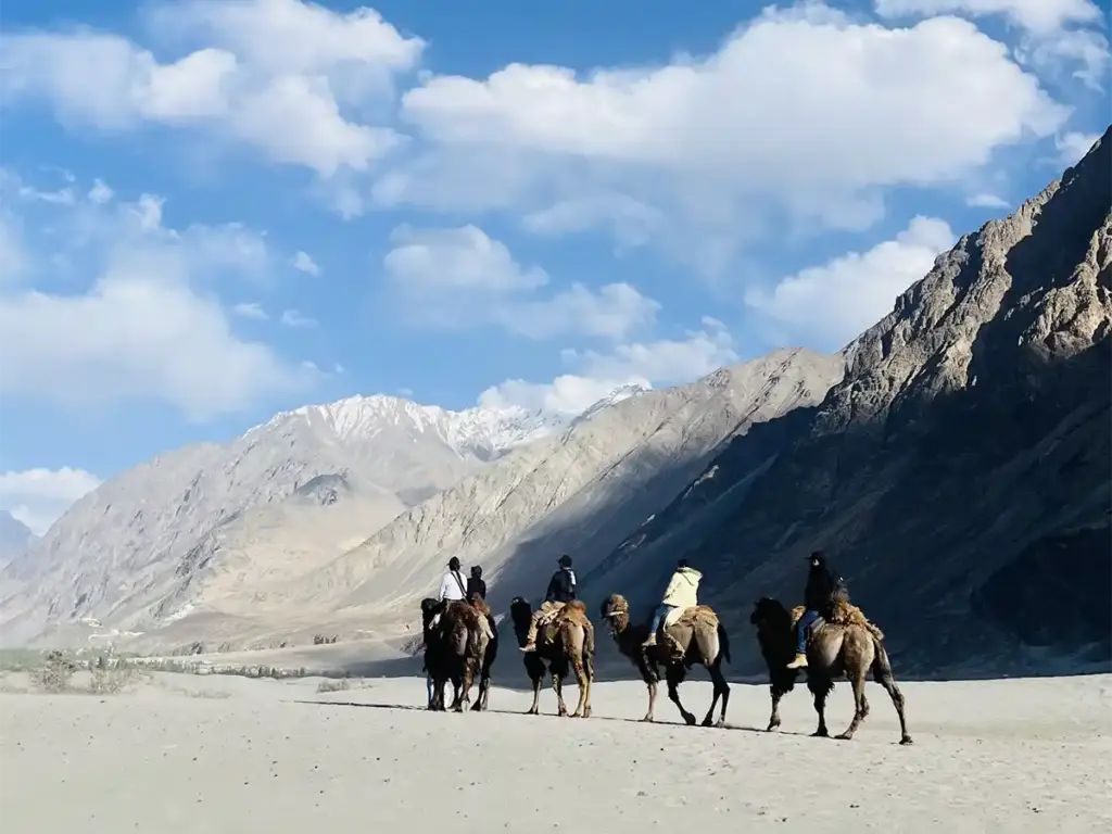
Tourists riding double-humped Bactrian camels through Hunder sand dunes in Nubra Valley, Ladakh, with snow-capped mountains in the background

Best Month to Visit Leh and Ladakh: What Nobody Tells You About Each Season

What is the best month to visit Leh and Ladakh? June and September are the most reliable months — both routes are open, skies are clear, and crowds are manageable. July and August are Ladakh’s monsoon months on paper but receive as little as 15 mm of total rainfall due to the Himalayan rain shadow — making them the best kept secret for fewer crowds and warm days. January and February suit Chadar Trek and snow leopard seekers only. Every travel guide on the internet confidently tells you to visit Leh and Ladakh between June and September. That’s not wrong — but it’s also incomplete enough to lead to poor decisions. It treats summer as one uniform block, ignores the genuine case for visiting in July and August, gives winter either a sentence or a paragraph, and fails to account for the fact that “best” depends entirely on what someone specifically wants from the trip. The honest truth: there is no single best month to visit Leh and Ladakh. There is a best month for each type of traveler, each type of experience, and each budget — and several of those months are ones that most guides dismiss without proper reasoning. Ladakh is a cold, high-altitude desert that sits behind the greatest natural rain barrier on earth. Understanding why that changes the monsoon calculus entirely is the starting point for making a genuinely informed decision. For travelers considering a structured circuit through Leh and Ladakh, The Travel Story’s Leh Ladakh Tour Packages runs supported batches through the season with logistics handled from day one. The Science Behind Ladakh’s Weather — and Why It Matters Before the month-by-month breakdown, one fact fundamentally changes the way Ladakh’s seasons should be understood: Ladakh receives approximately 100 mm of total precipitation per year. For context, Mumbai receives that much in a single monsoon afternoon. The reason is geological. The Great Himalayan Range blocks the monsoon clouds coming from the Indian plains, creating a rain shadow effect over Ladakh. The clouds exhaust their moisture on the southern slopes of the Himalayas and arrive in Ladakh’s cold desert essentially dry. Ladakh is a high-altitude cold desert in the rain shadow of the Himalayas with approximately 300 days of sunshine and only 100 millimetres of precipitation annually. This is the foundational fact that most “avoid monsoon” travel advice ignores. The monsoon isn’t hitting Ladakh — it’s hitting the roads into Ladakh. Those are two very different problems, with two very different solutions. Month-by-Month Guide: What Leh and Ladakh Actually Look Like Month Temp (Day/Night) Rainfall Crowds Roads Best For January -3°C / -20°C < 5 mm Very few Manali-Leh closed; fly only Chadar Trek, snow leopard sightings February -2°C / -18°C < 5 mm Very few Fly only Chadar Trek, frozen landscapes March 5°C / -12°C < 5 mm Low Opening slowly Shoulder season, low cost, quieter Leh April 12°C / -5°C < 10 mm Low–Medium Opening; Manali-Leh usually closed Early season, festivals, Leh basecamp May 18°C / 2°C < 10 mm Medium Manali-Leh opens late May Pre-peak, good passes, building crowds June 24°C / 8°C < 10 mm High Both routes fully open Peak access, full circuit, all passes open July 28°C / 12°C ~15 mm Lower than June Both open; approach roads risky Fewer crowds, warm days, affordable August 27°C / 11°C ~15 mm Lower than June Both open; approach roads risky Fewer crowds, clear skies in valley, affordable September 20°C / 5°C < 10 mm Medium Both routes open Best overall — clear skies, stable roads October 12°C / -5°C < 5 mm Low Closing; Manali-Leh risk Autumn colours, empty roads, crisp air November 0°C / -15°C < 5 mm Very few Manali-Leh closed Off-season, Leh city exploration only December -5°C / -20°C < 5 mm Very few Fly only Deep winter, Leh at its most local Why July and August in Ladakh Are Better Than Most Guides Admit This is the argument that the standard “best time to visit Ladakh” content consistently gets wrong — and the reason is simple: most writers conflate the monsoon experience in the rest of India with what happens inside Ladakh’s cold desert. Ladakh Is a Cold Desert — The Monsoon Barely Touches It Even though the months from July to September are considered to be the monsoon season in Ladakh, it receives extremely less rainfall, as it is located in a high altitude and rain shadow area. The specific numbers tell the story better than any description. Leh receives approximately 15 mm of rainfall during July — places that get less rain in two months than Mumbai gets on a single July afternoon. In most years, in 2012 and 2020, Leh received just 0.2 mm and 0.4 mm of rain respectively in July. These are not rounding errors — they reflect years when Leh received effectively zero monsoon rainfall. Most of the time during monsoon, the skies are clear, the weather is pleasant and it’s a great time for sightseeing, adventure and other activities that Ladakh is famous for. The Real Risk Is the Roads In — Not the Destination This is the nuance most planning guides miss. While Ladakh stays dry, the approach roads — Manali to Keylong on the Manali-Leh Highway and Jammu to Srinagar on the Srinagar-Leh Highway — get affected by heavy monsoon rains. The valley itself sits dry and sunny while the mountain passes on either side can see temporary blockages from landslides or water streams on the highway. The practical solution is straightforward: fly into Leh. Kushok Bakula Rinpochee Airport receives flights year-round from Delhi, Srinagar, Jammu, and Chandigarh. A traveler who flies into Leh in late July arrives into clear skies, warm days, and a valley that has received less than a month’s worth of Delhi humidity. Fewer Crowds, Same Destination Ladakh is less crowded in August because travelers who plan a road trip to Ladakh mostly avoid the monsoon season. This creates an unusual situation: the destination is

Best Month to Visit Leh and Ladakh: What Nobody Tells You About Each Season Read More »

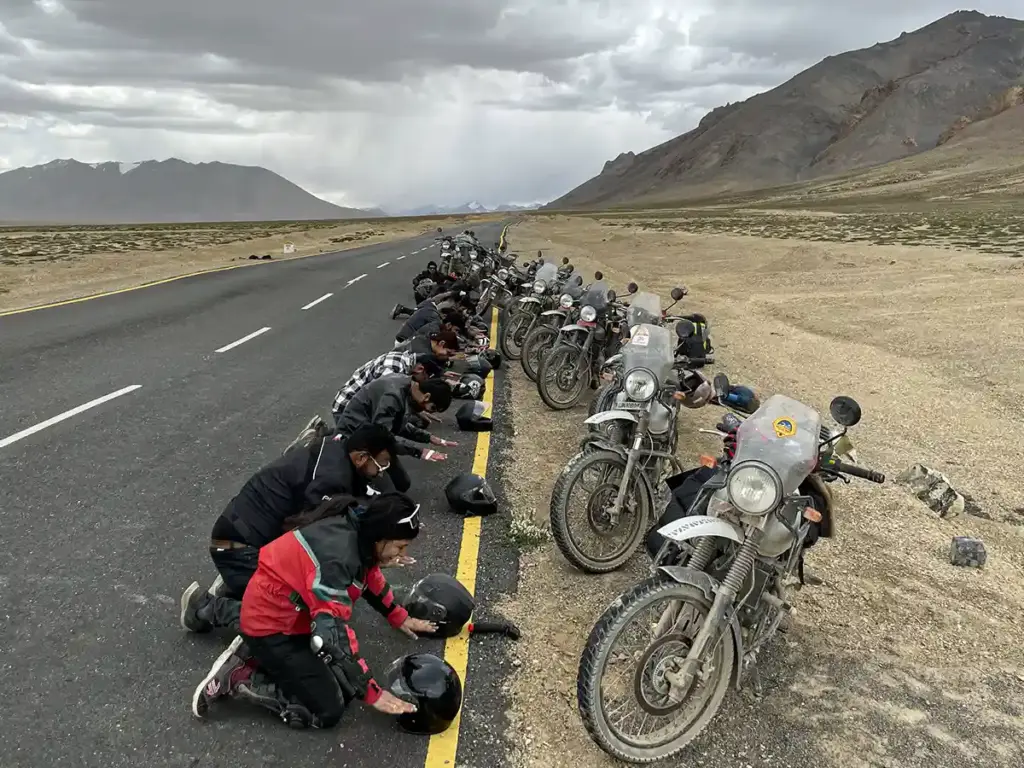
Group of bikers bowing on a well-paved Ladakh highway with Royal Enfield motorcycles parked roadside, open cold desert valley stretching ahead

Spiti vs Ladakh Biking: An Honest Comparison for 2026 Riders

Every serious biker planning a Himalayan trip eventually sits with the same question: Spiti or Ladakh? Both involve high passes, cold deserts, and the kind of roads that demand full attention. Both deliver landscapes that are genuinely difficult to describe to anyone who hasn’t been. And both carry a reputation that has grown considerably over the last decade as more riders make the journey each year. That last point is where the comparison starts to diverge. Ladakh has had a long enough spotlight for the economics of mass tourism to reshape significant parts of the experience. Spiti is catching up in search volume but remains structurally different in ways that matter to riders who care about more than ticking a pass. This guide breaks down what that difference actually looks like on the ground in 2026 whether it’s about the terrain, people, cost, support, or the routes that don’t appear in the standard comparison articles. For riders who want a structured, supported route through either destination, The Travel Story’s Spiti Biking Expedition covers the full Spiti circuit across 6 nights and 7 days, starting from ₹19,999 with the inclusions of a Marshall, Backup Vehicle and a Trip Captain. For riders leaning toward Ladakh, The Travel Story’s Leh Ladakh Full Circuit covers the complete Ladakh biking circuit with guided support. What Spiti vs Ladakh Biking Actually Means in 2026 The short answer: Ladakh offers more route variety, better infrastructure, and higher-altitude passes. Spiti offers rawer terrain, more authentic local culture, higher interaction with actual residents, and a circuit that changes character dramatically as it unfolds but for a rider who has already done Ladakh and wants something less mediated, Spiti is the natural next destination — though several experienced riders report they now choose Spiti first specifically to avoid Ladakh’s commercial trajectory. The People: Where Spiti and Ladakh Have Diverged Most Sharply This is the comparison that no distance table or altitude chart captures, but it’s the one that riders who have done both routes talk about most consistently. In Ladakh, the explosion in tourist volume over the last decade has fundamentally changed the economic fabric of the guesthouses and camps along the circuit. Many guesthouses in Leh and around Pangong Tso, Nubra Valley, and the main tourist corridors are now managed by people from other states — not locals. The hospitality is professional. It is not personal. The interaction most riders have with a “Ladakhi guesthouse” is transactional by design, indistinguishable in texture from a budget hotel in any hill station. In Spiti, this shift has not happened at the same scale. The villages along the circuit — Nako, Tabo, Kaza, Kibber, Langza, Losar, Hikkim — are still run by the families who built them. A rider who pulls into a homestay in Langza is likely to end up having butter tea in the family’s kitchen, talking about the last winter’s snowfall or the monastery festival scheduled for the following month. This is not a curated experience offered as a product. It happens because the hosts are farmers and monks who happen to take guests, not hospitality workers operating a business. The interaction gap between the two destinations is significant enough that experienced riders who have completed both circuits regularly cite it as the primary differentiator. Spiti’s villages have not been rewired for tourist consumption yet. The people who live there are the people you talk to — and that distinction is becoming rarer across the Himalayas with every passing season. Terrain: What Each Route Actually Demands From a Rider Ladakh: The main circuits — Manali-Leh highway, Srinagar-Leh, and the standard Pangong-Nubra-Khardung La loop — are increasingly well-paved. Khardung La (5,359 m), once famous for its rough surface, now has tarmac to the summit and a food stall at the top. The BRO has progressively improved most main-route surfaces. This makes Ladakh significantly more accessible than it was five years ago, which is both its strength for newer riders and its weakness for those seeking technical challenge. Spiti: The Spiti circuit is structurally more demanding, and by design. The Manali approach still requires navigating the Gramphu-Batal stretch — unpaved, with multiple water crossings where the depth increases as the day goes on because snowmelt feeds the streams through the afternoon. A crossing that is manageable at 8 AM can be genuinely risky by 2 PM. The Shimla-Kinnaur or Manali-Jibhi-Kinnaur approach is better, but narrows and roughens past Nako as the valley opens into the cold desert. The Losar-Chandratal-Koksar Route: Spiti’s Real Test This is the stretch that separates Spiti biking from every other Himalayan circuit. After Losar, the last village in Spiti before the Kunzum Pass — the route toward Chandratal and onward to Koksar through Gramphoo is completely unpaved. No tar. No defined lanes. Tracks through loose gravel, river crossings, and open terrain where the “road” is a line that previous vehicles have worn into the hillside. The landscape through this section changes in a way that no single other circuit in the Indian Himalayas matches. From Losar, riders cross through high-altitude plateau terrain, descend toward the Chandratal catchment, climb again toward Kunzum, and emerge at Koksar into the Lahaul Valley — the terrain shifting from cold desert to glacial rock to green valley floor across a single day’s riding. At Chandratal itself (4,300 m), the lake is a crescent of water at an altitude where the light bends differently and the silence is measurable. The Koksar approach adds river-crossing technical riding that most Ladakh routes simply don’t offer in the same concentration. Riders who specifically seek offroad capability — those running adventure-oriented machines with proper ground clearance — cite this stretch as the reason Spiti biking is categorically different from the Ladakh experience in 2026. Cost and Accommodation: The Practical Gap Spiti is consistently less expensive than an equivalent Ladakh trip, with the cost difference concentrated in two areas: Accommodation: Homestays in Spiti villages — Nako, Langza, Komic, Hikkim, Losar — typically run ₹800–1,500 per night per

Spiti vs Ladakh Biking: An Honest Comparison for 2026 Riders Read More »

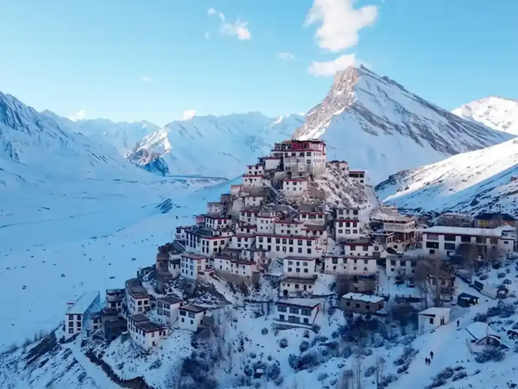
A striking high-angle view of the iconic Key Monastery perched on a hill, completely enveloped by a massive, snow-covered landscape and frozen mountain valley in winter.

Best Time to Visit Spiti Valley: What Actually Happens Each Month

Most “best time to visit Spiti Valley” guides are written from a spreadsheet, not a windshield. They average out rainfall data, glance at a few road-status reports, and land on the same three conclusions every time: June through September, avoid winter, August is peak season. None of that is technically wrong — but none of it reflects what someone who has actually stood in Kaza market in January, or watched a tent shortage turn travellers away from Chandratal in June, would tell a friend planning the trip. This guide is built from that second kind of knowledge — patterns that only become visible after watching Spiti across every month, not just the popular ones. The Standard Advice Is Already Out of Date For years, the safe answer was simple: Spiti shuts down in winter, opens in late May, and the reliable window runs July through September. That’s no longer the full picture, for two reasons most guides miss entirely. First, the shoulder season around Holi has shifted. As the Sangla Holi Festival has grown in popularity over recent years, March now pulls in a genuine surge of travellers timing their trip around it — something that simply wasn’t true a few years back. Winter in Spiti effectively runs from late December through March, ending not when the calendar says spring begins, but when this festival crowd arrives. Second — and this catches almost every first-time planner off guard — December has quietly become one of the busiest stretches of the year, not one of the quietest. The December 20–New Year Problem Anyone who has spent late December in Spiti over the last couple of seasons has watched the same thing play out: travellers arrive expecting an empty, snowed-in valley and instead find every homestay and guesthouse fully booked. With nowhere to stay, some have had to descend back toward Kinnaur late at night; others have ended up sleeping in their own vehicles — which, at -20°C to -30°C, isn’t just an uncomfortable night. It’s a genuine health risk by the next morning. This is the single biggest correction to the “winter is quiet” assumption: if traveling between December 20 and New Year’s, accommodation needs to be booked as far in advance as peak summer — not as an afterthought. January through early March, outside the Holi window, remains genuinely quiet. That part of the old advice still holds. What Winter Actually Demands Winter cold here isn’t a number on a forecast app — it’s a planning requirement. Temperatures sit between -20°C and -30°C through January and February, and underestimating this is the single most common way people get sick on a winter trip. Layering isn’t a nice-to-have; at minimum, three proper layers are needed for anyone spending real time outdoors. Daily rhythm changes shape too. Shops close well before evening, and in Kaza market specifically, most cafés don’t open at all through the coldest stretch — a detail that surprises travellers expecting the same market pace they’d find in July. For anyone who specifically wants to see Spiti completely under snow — not just cold, but visibly white from end to end — late January through mid-February is the window. This stretch also happens to overlap with the best chances for snow leopard sightings, with Kibber and Chicham offering the strongest odds in late December and early January, as the animals move down to lower elevations. June Looks Like Peak Season Because It Is The other major gap in standard advice is treating “summer” as one undifferentiated block. In practice, late May through June functions as its own peak season — and in some ways, a busier one than July or August. The clearest evidence: in the first week of June 2026, shortly after Chandratal reopened for the season, an estimated 3,500 vehicles — a mix of tempo travellers, cars, bikes, and campers — arrived at the lake. The campsite, located roughly 2 km before the Chandratal parking area, ran out of tents, and a significant number of travellers had to turn back without a place to stay. This wasn’t a one-off; June crowd pressure at Chandratal has been building for several consecutive seasons. There’s a second, more specific June problem worth knowing by name: Tabo. Each June, groups of practicing yogis travel to Tabo Monastery and pre-book homestays for their stay — often weeks ahead — leaving very little available for general travellers. Anyone planning to base themselves near Tabo in June is better off considering Nako, Hurling, or Poh village instead, all of which sit within easy reach of the same stretch of road. Pricing follows the same pattern: rates climb sharply for the Christmas window in December and stay elevated through all of June — not just during the traditional July-August window most guides flag as “peak.” July: Spiti Stays Dry, the Roads In Don’t Spiti itself sits in a rain shadow and genuinely sees very little monsoon rainfall — that part of the standard advice holds up. What usually gets left out is that both approach routes, Shimla-Kinnaur and Manali, can see heavy rainfall in July even while Spiti proper stays dry. The practical fix is straightforward: check a reliable forecast source like AccuWeather for the approach route specifically, not just for Spiti itself, before setting out in July. September and October: Clear Skies, Unpredictable Edges September and October bring less rainfall overall, but “less rain” doesn’t mean “predictable.” Weather here can shift fast — a clear morning can turn to snow by afternoon, or stay clear for days straight. Most days remain clear, but the moment cloud cover blocks the sun, temperatures drop quickly enough to catch people off guard. Keeping a jacket within reach, even on a clear-looking morning, isn’t optional in this window. This is also where the most important correction to standard advice sits: based on past seasons, Chandratal has closed in early October more than once. September isn’t just the “nicer” month for Chandratal — for most years, it’s the

Best Time to Visit Spiti Valley: What Actually Happens Each Month Read More »

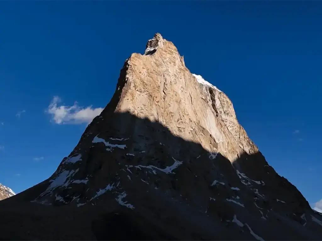
The sacred, standalone rocky peak of Gonbo Rangjon mountain towering into a deep blue sky, a famous natural landmark and campsite along the Shinku La route to Zanskar Valley.

Zanskar Valley: The Complete Travel Guide 2026

There are valleys in the Himalayas that draw travellers with polished infrastructure, well-marked trails, and mobile signal at camp. Zanskar Valley is not one of them. Tucked into the Kargil District of Ladakh at elevations ranging from 3,500 to 7,000 metres above sea level, Zanskar sits behind walls of rock, ice, and altitude that have kept it insulated from mass tourism longer than almost anywhere else in the Indian Himalayas. That isolation is its defining quality. The valley runs roughly north to south, drained by the Zanskar River — a tributary of the Indus — and flanked by ranges that block the monsoon entirely, turning the valley into a cold desert of exceptional clarity. The main administrative centre is Padum, a town of a few thousand residents that functions as the gravitational centre for a region of monasteries, glaciers, sacred peaks, and trekking routes that have been connecting Tibet, Ladakh, and the Himalayan foothills for centuries. For travelers who want to understand Zanskar Valley before committing to the journey, The Travel Story’s Zanskar Valley expedition covers the full circuit — Shinkula Pass, Phugtal Monastery, Gonbo Rangjon, and Padum. “Zanskar doesn’t ask for your plans. It asks for your patience.” Zanskar Valley: Key Facts at a Glance Detail Data Location Kargil District, Ladakh, India Average Elevation 3,500–7,000 m above sea level Main Town Padum (3,657 m) Best Time to Visit June to September Winter Access Chadar Trek — January to mid-February Key Pass (Manali side) Shinkula Pass — 5,091 m (16,703 ft) Key Pass (Kargil side) Pensi La — 4,401 m (14,436 ft) Major River Zanskar River (tributary of the Indus) Notable Landmarks Phugtal Monastery, Karsha Monastery, Gonbo Rangjon, Drang Drung Glacier, Sani Lake, Mobile Network BSNL, Jio and Airtel limited connectivity in the valley What Makes Zanskar Valley Different Most Himalayan destinations offer a gradient and then you move from connected lowlands into progressively wilder terrain, with escape routes at every stage. Zanskar Valley does not operate on that model. There are only two main road exits first one is Shinkula Pass to the south and the other Pensi La to the north — are both high, weather-dependent, and seasonally closed. The valley operates on its own terms. Zanskar forces a kind of commitment that produces a corresponding depth of experience. The monasteries here are not heritage sites maintained for tourism — they are functioning institutions where monks have lived, studied, and practised for centuries without interruption. The villages are not curated for visitors. The landscape is simply what the landscape remianed up until now like brown mountains, glacier-fed rivers of extraordinary colour, and skies that reward the absence of light pollution with a generosity most travellers do not encounter elsewhere. The Two Routes Into Zanskar Valley Route 1 — Manali to Gonbo Rangjon via Shinkula Pass Full route: Manali → Keylong → Jispa → Shinkula Pass (5,091 m) → Lakhang → Gonbo Rangjon → Purne → Padum The road climbs through the Lahaul Valley before ascending to Shinkula Pass at 16,703 ft — the highest point on this approach and the gateway into Zanskar from Himachal Pradesh. Shinkula typically opens in late May and closes by mid-November. Immediately after descending from the pass, the road reaches the base of Gonbo Rangjon — a solitary, pyramidal sacred peak that rises from the valley floor without the company of surrounding ridges. Locals across Zanskar revere it as a protector mountain; many believe the cliff face carries the image of the Buddha. It marks the psychological entrance to Zanskar as much as the geographical one. The road continues through Kargiakh — the first village of Zanskar — past Muney Monastery and Bardan Monastery, before reaching Purne and then Padum. Route 2 — Kargil to Gonbo Rangjon via Suru Valley and Pensi La Full route: Srinagar → Sonmarg → Zoji La → Kargil → Suru Valley → Rangdum → Pensi La (4,401 m) → Padum → Gonbo Rangjon The Suru Valley approach offers a different landscape from the Manali route — green lower valleys that harden progressively into cold desert terrain as the road climbs toward Rangdum. Before Pensi La, the road passes the Drang Drung Glacier — approximately 23 km long, it is one of the largest glaciers in the western Himalayas and the only glacier in India accessible directly by road. The twin glacial lakes of Stat Tso and Lang Tso sit at the pass itself. From Padum, the road to Gonbo Rangjon heads south through Purne toward the mountain’s base. The Landmarks That Define Zanskar Valley Phugtal Monastery — Lungnak Valley Built into the cliff face of the Lungnak Valley in southeastern Zanskar, Phugtal is among the most visually extraordinary religious sites in the entire Himalayan region. The complex is constructed inside and around a natural cave — the structure extends outward from the rock face in tiers, resembling what many visitors describe as a honeycomb pressed into a cliff. Until the Nimmu-Padum-Darcha (NPD) road was completed in 2022, Phugtal was reachable only by multi-day trek. Today, the trailhead at Purne is road-accessible; the monastery requires a 1.5 to 2-hour hike along the turquoise waters of the Tsarap River. The colour shifts from deep teal to glacial blue depending on the season and light — a consistent feature of every account of the approach. The monastery is an active centre of Tibetan Buddhist scholarship. Visitors are welcome and should remove footwear at the entrance, maintain silence in prayer halls, and seek explicit permission before photographing monks or ceremonies. Karsha Monastery — Above Padum The largest monastery in Zanskar Valley, Karsha dates to the 10th century and sits on a hillside above the Stod River near Padum. Its whitewashed walls, ancient murals, and position make it the most visited religious site in the valley. The annual Karsha Gustor festival — typically held in July or August — draws the entire regional community and is one of the most significant cultural events in Zanskar’s calendar. Gonbo Rangjon — The Solitary Sacred

Zanskar Valley: The Complete Travel Guide 2026 Read More »