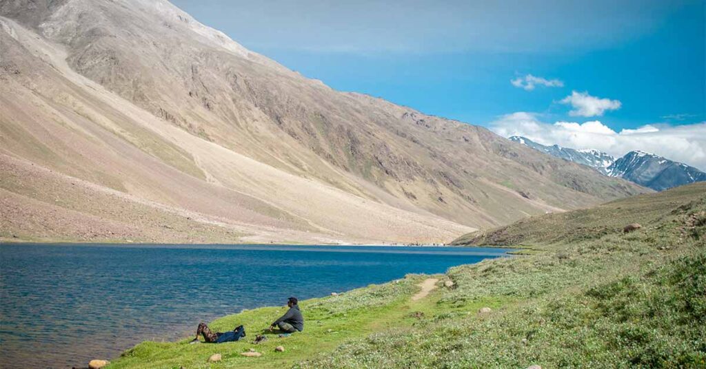
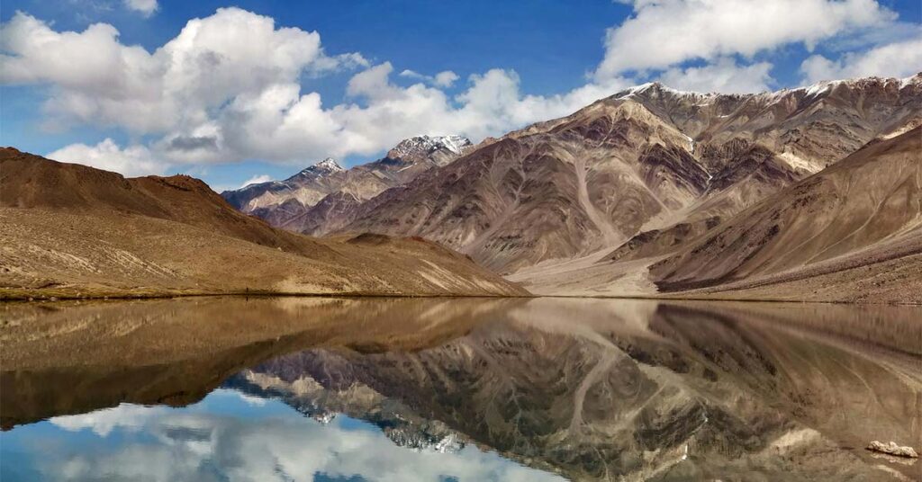
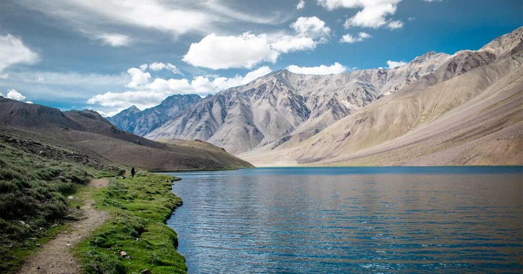
There are some moments that remain with you forever and just like that somewhere between Kunzum Pass and the edge of the Spiti Valley where the road ends, the silence swallows everything a crescent-shaped lake appears out of nowhere, shimmering in shades of blue and green that don’t feel like they belong on this planet. That’s Chandratal. And once you see it, it’s very hard to stop thinking about it.
If you’ve been researching Himalayan lakes and wondering whether Chandratal is worth the effort then without a second thought you should go for it but if you have no idea how to reach there on your own then you just need to join our Spiti with Chandratal batches . But only if you go in prepared. This guide will tell you exactly what Chandratal is, why it matters, when to go, how to get there, and what nobody tells you before you leave.
Why Chandratal Lake Is Special?
Chandratal Lake sits at an altitude of roughly 4,300 metres (14,100 feet) in the Lahaul and Spiti district of Himachal Pradesh. The name means “Moon Lake” in Hindi — named for its distinctive crescent shape when viewed from above.
It’s part of the Chandratal Wildlife Sanctuary and is listed as a Ramsar Wetland of International Importance, which means it’s ecologically protected. The lake feeds into the Chandra River, a tributary of the Chenab.
Beyond geography, Chandratal carries real cultural weight. Local legend holds that this is where the god Indra descended to take the legendary warrior Yudhishthira to heaven, leaving his human body behind at the water’s edge. Whether or not you follow the mythology, standing at that shore — sky above, snow peaks all around, zero phone signal — it’s not hard to see why people believed something divine happened here.
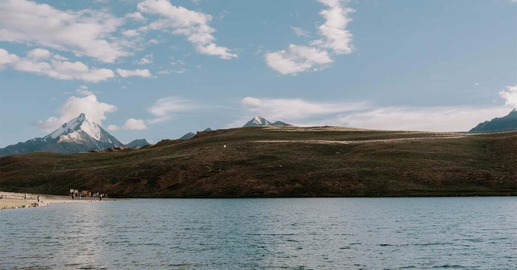
What makes this lake so different from more popular Himalayan lakes like Pangong Tso is the relative rawness of the experience. There’s no town nearby. No chai shops right at the edge. No loud tourists roaming around. You park your vehicle, walk 1-1.5 km, and then you reach Chandrataal where you are completely alone with the lake. That’s increasingly rare in the Indian Himalayas.
Best Time to Visit Chandratal Lake
This is one of the most important decisions you’ll make. Chandratal isn’t accessible year-round. The road to the lake is buried under snow from October to May, and getting the timing wrong means either a wasted trip or a dangerous one.
June to mid-July is the most popular window. The snow is melting, the landscape is green and dramatic, and the sky is usually clear. Temperatures at the lake range from 5°C to 10°C during the day and drop to near freezing at night.
Mid-July to August brings the monsoon. The Manali route can become risky due to landslides and flooded roads. If you’re approaching via Shimla and Spiti, the risk is lower (Spiti sits in a rain shadow), but it’s still worth monitoring the road conditions daily.
September to early October is arguably the best time for experienced trekkers and photographers. The crowds thin out significantly, the air is crystal clear, and the high-altitude colours shift to warm, earthy tones. However, temperatures drop fast — night temperatures can fall below -10°C by late September.
After mid-October — don’t bother. The roads close, and anything beyond that is for trained mountaineers only.
| Period | Conditions | Best For |
| June – mid-July | Open, green, mild | First-timers |
| Mid-July – August | Monsoon risk (Manali side) | Spiti-side travellers |
| September – early Oct | Clear, cold, fewer crowds | Photographers, trekkers |
| After mid-October | Roads closed | Avoid |
How to Reach Chandratal: Your Route Options
There are two main routes to Chandratal, and they’re not equally easy. Your starting point, travel budget, and risk tolerance should determine which one you pick.
Route 1: From Manali via Atal Tunnel
Distance: ~115 km from Manali to Chandratal
Estimated travel time: 6–8 hours (on a good day)
Road condition: Very rough.
This is the shorter route, and the one most adventure travellers use. Here’s the sequence:
- Manali → Atal Tunnel: About 30 km. The tunnel has shortened total distance and reduced time significantly. You will enter Lahaul and Spiti Valley once you cross it.
Atal Tunnel → Gramphoo → Batal: After Tunnel, the road drops into the Lahaul Valley and the landscape changes completely. You leave the pine forests behind and enter high-altitude desert terrain. Batal is a small dhaba settlement at the base of Kunzum Pass — this is where many travellers stop for food and tea. - Batal → Chandratal parking area: About 16 km from Batal. There’s a parking lot at the trailhead. From there, you walk 1–1.5 km to reach the lake.
How to travel: Private taxis from Manali (Innova or Bolero) and Organized tours that include Chandratal cost ₹8,000–₹15,000 per person for 2-3 day itineraries.
Route 2: From Shimla via Spiti Valley (Kinnaur-Spiti Route)
Distance: ~430 km from Shimla to Chandratal
Estimated travel time: 3–4 days
Road condition: Long, but generally better maintained than the Manali route
This is the classic Spiti Valley road trip route. You drive through Kinnaur, then Spiti, and approach Chandratal from the Losar side.
- Shimla → Narkanda → Rampur → Pooh → Nako → Tabo → Kaza: This stretch covers about 400 km. The road follows the Sutlej and Spiti rivers through spectacular gorges.
- Kaza → Losar → Chandratal: From Kaza, it’s about 100 km to Chandratal via Losar. The road from Losar to the lake is the same rough track as the final leg from the Manali side.
How to travel: Most people doing this route book either private tours or group tours. Buses from Shimla to Kaza run a few days a week (HRTC), and from Kaza you can arrange local transport to Chandratal.
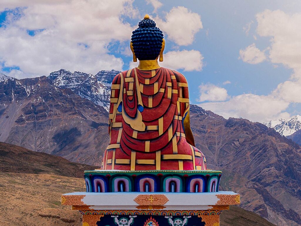
Scenic highlights: Kinnaur Valley and its apple orchards, Nako Lake, Pin Valley, Key Monastery near Kaza, Chicham Bridge (the highest motor bridge in Asia), the vast open expanse of Spiti.
This route is highly recommended if you have 7-9 days and want a complete Himalayan road trip, not just a quick lake visit.
Practical Tips and Safety Advice
This is where most travel blogs either skip to pretty photos or give vague advice. Here’s the honest version:
Altitude sickness is real. At 4,300m, even fit people feel the altitude. If you’re coming from Delhi, don’t rush straight to Chandratal in one day. Spend at least one night in Manali (2,050m) or ascend gradually from Shimla. Headaches, nausea, and dizziness are warning signs. Shortness of breath at rest or confusion means you need to descend immediately.
Weather can turn fast. Even in June, snowstorms can appear without warning at this altitude. Check weather forecasts, carry warm layers regardless of the daytime temperature, and have a plan if you need to turn back.
The road is genuinely bad. Do not attempt the Kunzum Pass road in a vehicle that isn’t built for high-clearance, rough terrain. Breakdowns in this area are serious because mobile networks are non-existent near the lake and the nearest mechanic is hours away.
Carry enough fuel. There are no petrol pumps between Manali and Kaza on the Manali side. Fill up fully in Manali. If approaching from Spiti, fuel up in Kaza.
Take your trash back with you. Chandratal’s ecosystem is fragile and protected. Littering here is both illegal and genuinely harmful to a place that deserves better.
What to pack:
- Warm base layers, fleece, and a windproof outer shell
- Sunscreen (UV exposure at altitude is severe)
- AMS (altitude sickness) medication but consult a doctor before travelling
- A first aid kit
- At least 2–3 litres of water per person (there’s no water source at the parking area)
- Carry cash because there are no ATMs beyond Kaza
The Honest Bottom Line
Chandratal Lake rewards preparation and punishes overconfidence. It’s not a casual weekend trip unless you’re already based in Manali or Kaza. The roads are hard, the altitude is real, and the weather is unpredictable. But if you respect all of that and go in ready, you’ll arrive at a lake that genuinely looks like it was put there for no practical reason at all — pure beauty, at the edge of the habitable world.
Very few places in India still feel like discoveries. Chandratal is one of them.
Frequently Asked Questions About Chandratal Lake
Q: When does Chandratal Lake open?
The lake opens up from early June to early October. Outside this window, the access roads are closed due to snowfall.
Q: Can I camp at Chandratal Lake overnight?
Yes, in designated camping zones near the trailhead. Camping directly at the lake’s edge is prohibited.
Q: Which route to Chandratal is better — Manali or Shimla?
If you have 2–3 days, use the Manali route. If you have 7–10 days and want the full Spiti Valley experience, the Shimla route is far more scenic and fulfilling.
Q: Is Chandratal safe for solo travellers?
Generally yes, but the remoteness means you should be well-prepared and ideally travel with at least one other person. Mobile connectivity is virtually zero in the surrounding areas.
Q: Do I need a permit for Chandratal Lake?
Indian nationals do not need a special permit for the lake itself. Foreign nationals need a Protected Area Permit for Spiti.